Epilogue
and
Other Long Distant Hikes
2021-2026
Epilogue
…as revealed in the title of this book, the “Rocks” part was always in plain view and on my mind. It was fun and rewarding afterwards, combing through geologic maps and reports learning, confirming, and discovering lithological and structural aspects of the rocks about which I had spent so many months pondering. As a “soft rock” geologist (I mainly study sedimentary rocks), it was a relearning experience to get back to understanding the complexities of “hard rocks” (igneous and metamorphic rocks).
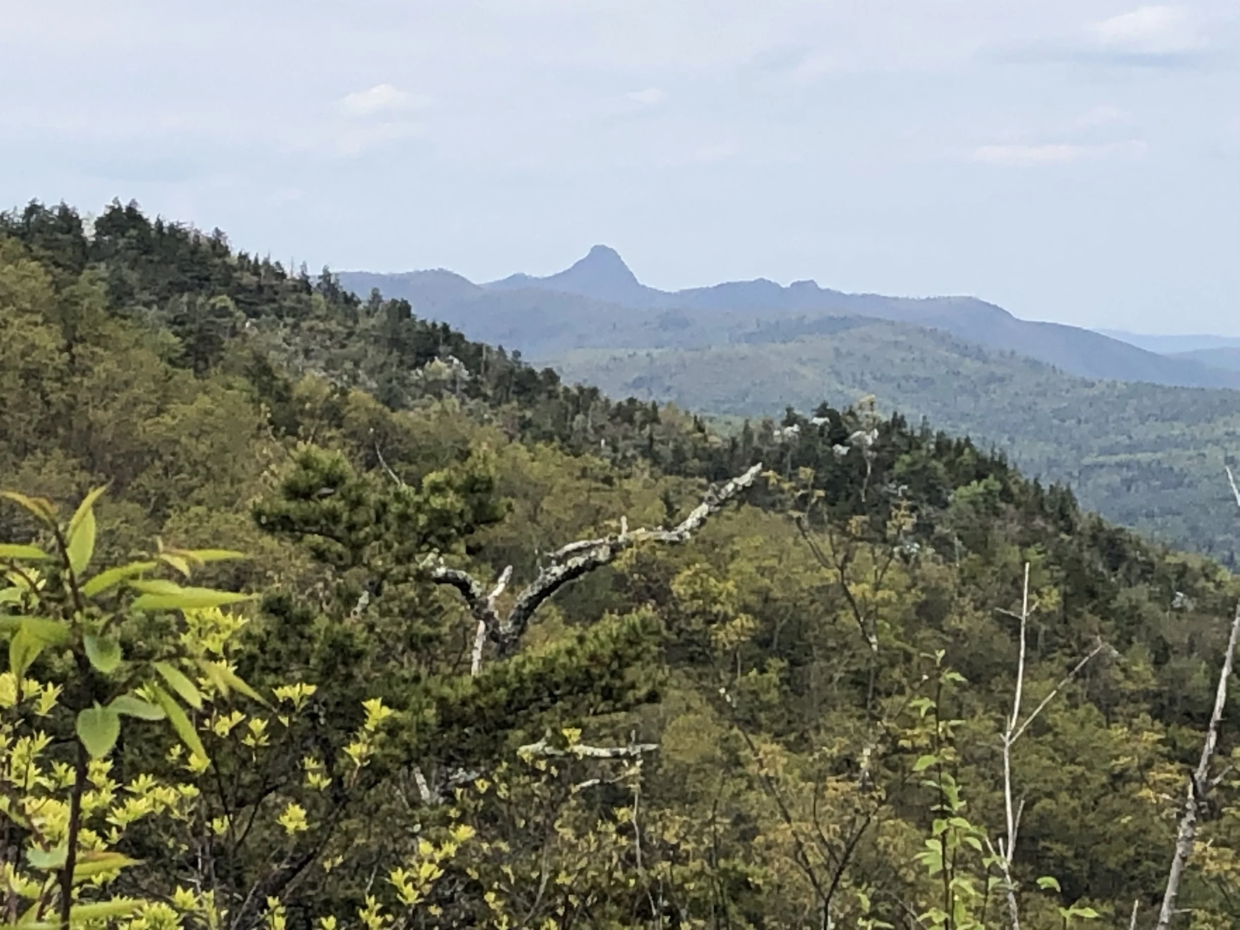
The path I followed on the AT was just one route of many through this storied chain of ancient, eastern mountains. I look forward to delving deeper into many more of the hidden gems lying out there to be explored. I recently spent four days in the Linville Canyon of western North Carolina exploring the rocky gorge and its many elusive trails. I was amazed at the geology and resulting physiography where the Linville Falls Thrust Fault, which formed the Grandfather Mountain Window, left behind an impressive escarpment of more resistant, cliff-forming Chilhowie Group quartzite units rimming the gorge.
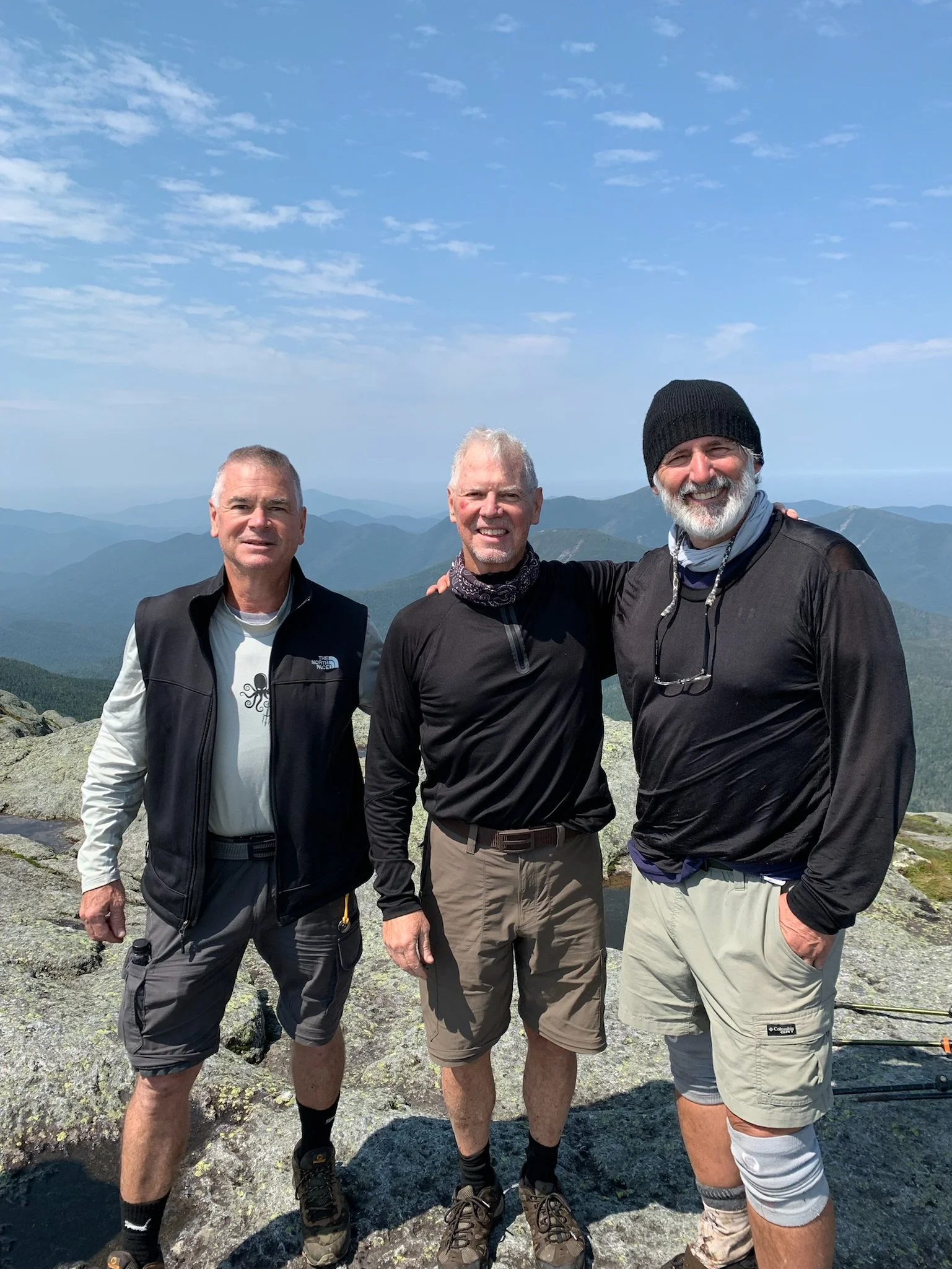
Another trek I completed this summer with my old friend and fellow geologist Bob Heim, and his youngest son Ben, was the 70-mile Laurel Mountain Hiking Trail of western Pennsylvania. This trail essentially follows the ridgeline of Laurel Mountain, beginning at the Conemaugh River Gorge near Johnstown to the Youghiogheny River Gorge at Ohiopyle. Laurel Ridge is the structural expression of the Laurel Hill Anticline, one of the primary Salina cored anticlines within Pennsylvania’s high plateau province. It was fun hiking over many of the geologic structures, which I have spent hundreds of past hours mapping from interpreted seismic and old gas-well data. Additionally, our hike led us through Seven Springs Ski Resort, which although I had been to a hundred times, I had never seen without snow!
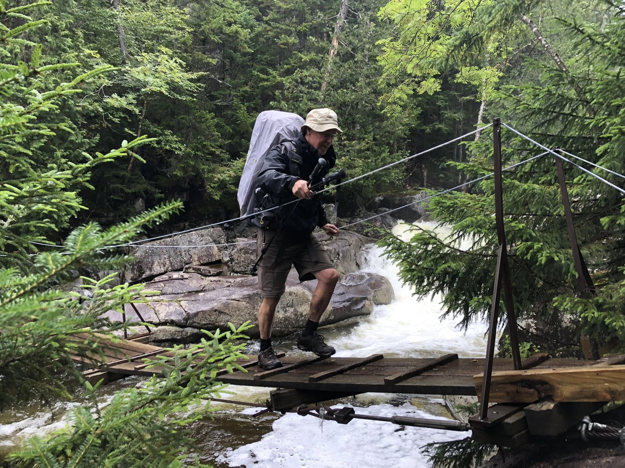
In July I once again met up with Bob and his eldest son Nate, and we hiked together for the first 100 miles of the Long Trail (LT) in Vermont. At Willard Gap, Bob went east toward New Hampshire and I continued north to finish the entirety of the LT (on July 28). The 273 miles took me deep into the wilderness of the northern sections of the nation’s oldest continuous footpath, over such spectacular mountains as Camel’s Hump, Mt. Mansfield, Belvidere Mountain, and Jay Peak. Of the 22 days I spent trekking over the rugged terrain of the Green Mountain Massif, only four of those days were without rain. On the days where visibility was afforded to me, the views were indescribably breathtaking.
Long-distance hiking is a great way to explore and discover more about the country and world in which we live. There are countless other well-established trails to hike on foot, such as:
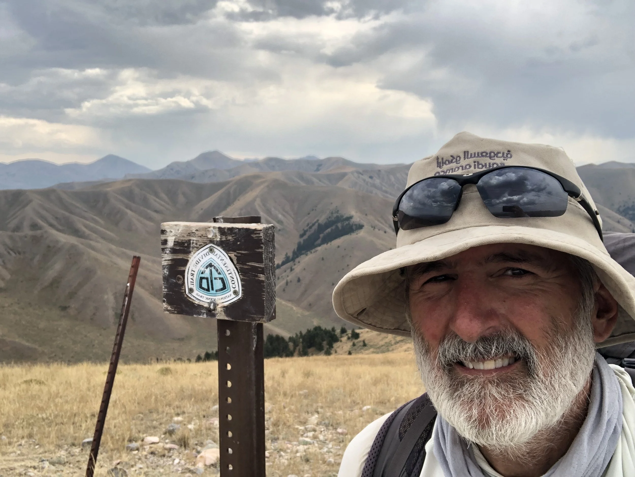
• The Pacific Crest Trail (PCT) and the Continental Divide Trail (CDT), the 2nd and 3rd parts of the hiker’s North American Triple Crown.
• A northern, and trans-Atlantic extension of the AT, known as the International AT, is a geologist’s true paradise of revisiting Pangaea on foot. This trail begins at Katahdin, and continues north into Maritimes Canada, eventually jumping across the ocean to the British Isles, Scandinavia, and other coastal parts of western Europe.
• The 1,400-mile-long Buckeye Trail in Ohio
• The 4,600-mile-long North Country Trail from New York to North Dakota
• And so many others in the Adirondacks of New York, or the Highlands of western North Carolina, just to name a few. Of course, each of these has a great geologic story to be revealed.
So many miles of trail, so little time…

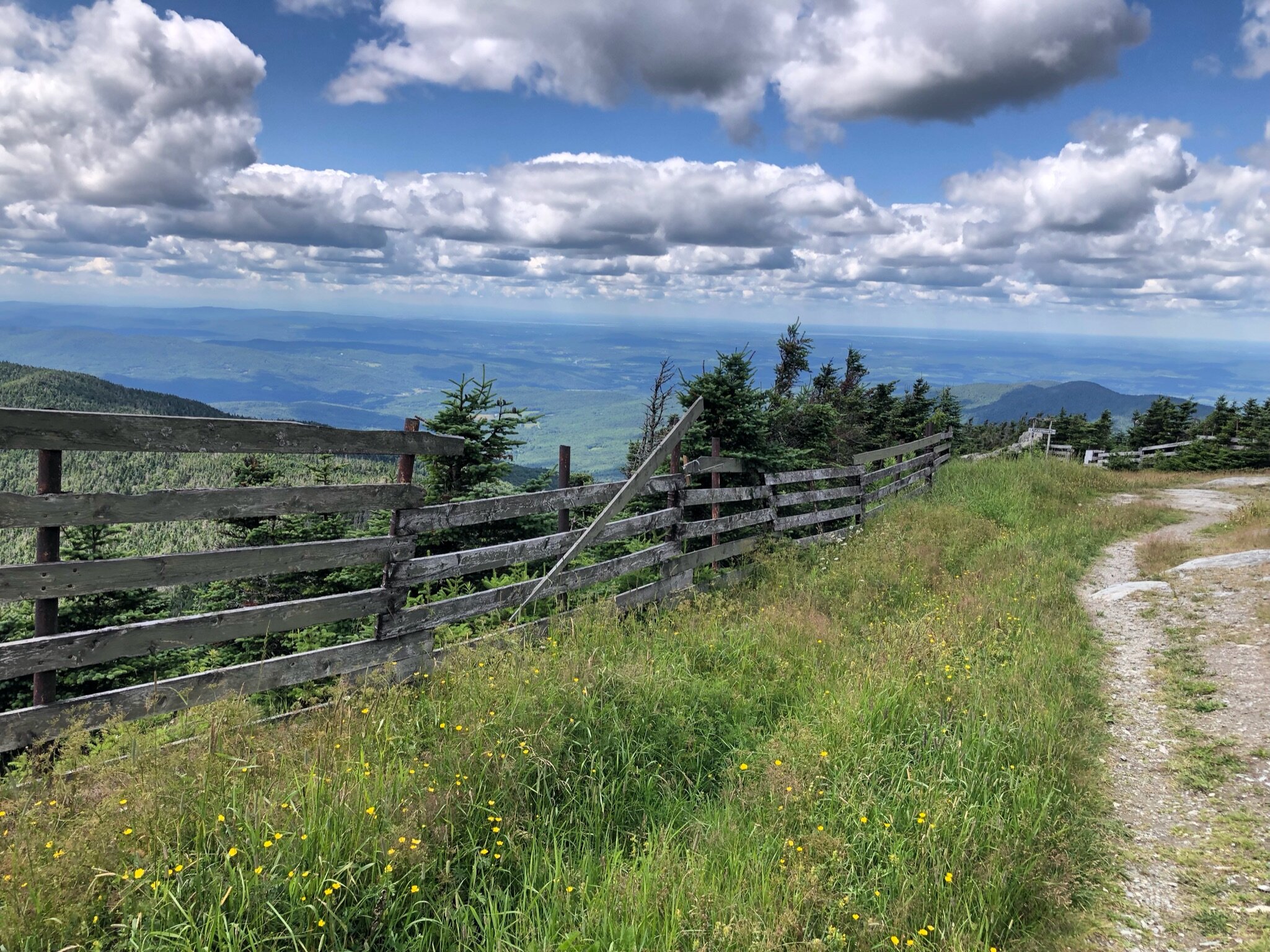
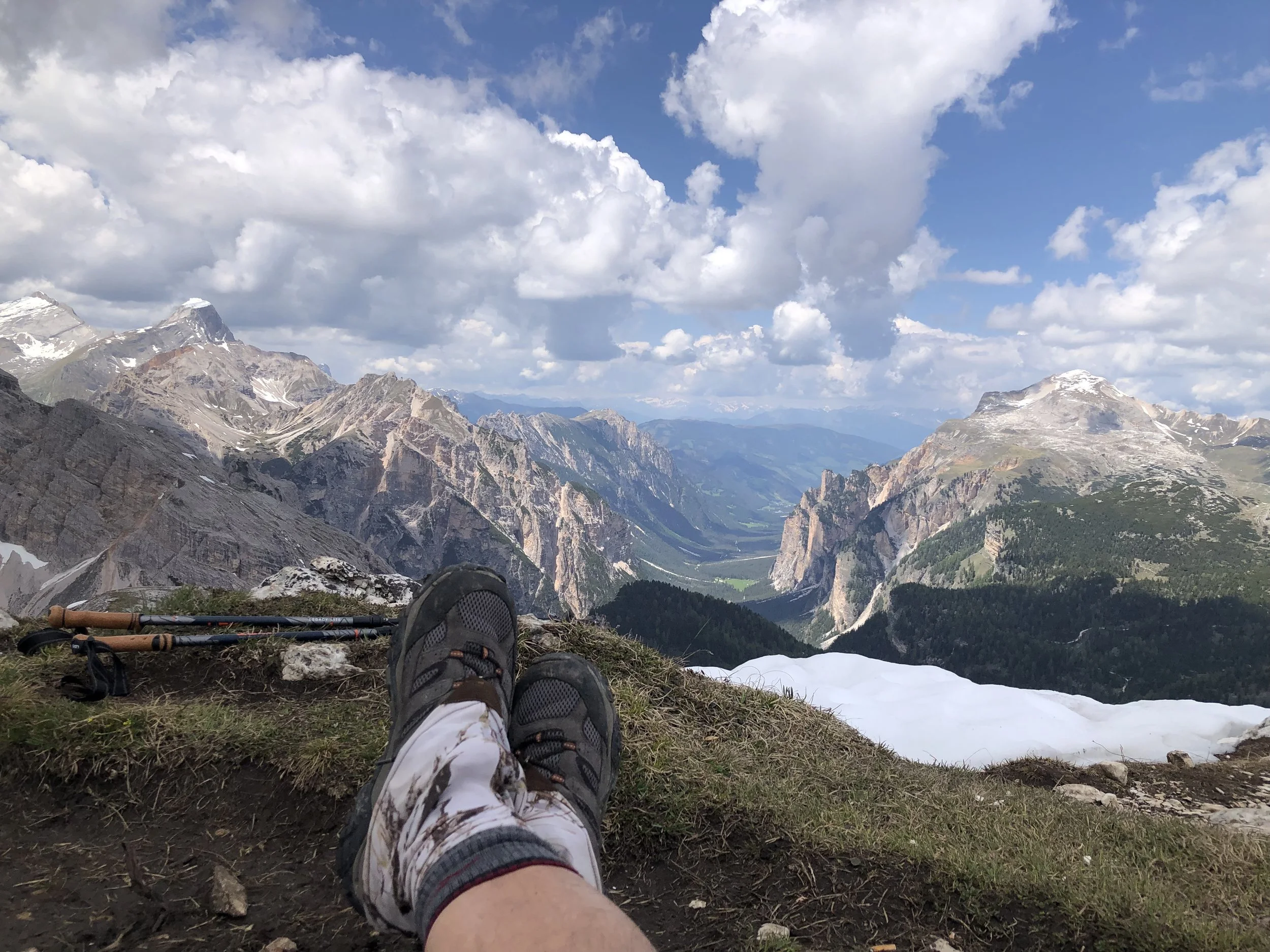
Looking east to sunrise shrouded in clouds over Avery Peak, from summit of West Bigelow Peak, Maine
Below are some other trails that I hiked throughout the Appalachian Mountains and beyond, from 2021 through 2026.
Linville Gorge, NC
April 2021, 35 miles
-

Looking north into the Linville Gorge Wilderness
Beginning at a parking lot at the base of Shortoff Mountain, the trail steadily climbs up to the Chilhowee quartzite escarpment rimming the entire Linville River Canyon.
-

A view of Lake James looking south from Shortoff Mountain
Standing on Shortoff Mountain cuesta looking south toward Marion, NC. Recent forest fires have scalded the ridgetops along the southern part of the east rim.
-

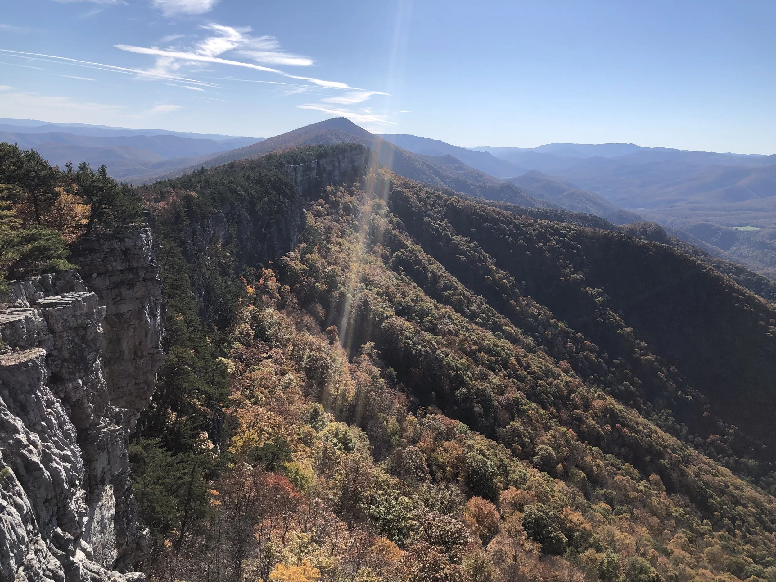
View of gorge from Hawksbill Mountain
View looking south from Hawksbill Mountain. Table Rock is on left of photo behind Hawksbill, with escarpment clearly defined rimming the canyon walls.
-

North view from East Rim Wilderness.
Spectacular northern view of gorge. Carolina rhododendron ready to burst into bloom all around me.
Laurel Highlands Hiking Trail, western PA
June 2021, 70 miles
-

Start of hike at northern terminus with Ben and Bob Heim
Beginning at a parking lot at the north terminus near Johnstown, PA, the LHHT slowly gains elevation from the Conemaugh gorge to the ridge line trail.
-

Textbook cross-bedding near base of massive Pennsylvanian age fluvial sandstone
Laurel Hill Anticline defines this impressive NNE trending series of ridgelines along which the Laurel Mountain Hiking trail follows for 70 miles.
-

With Bob at Seven Springs Ski Resort on LHHT
The LHHT passes thru Seven Springs, passing over several spectacular vistas such as this one overlooking northface slopes. Gunnar chair base can be seen in distant valley over my right shoulder.
-

Looking south into the Youghiogheny gorge near Ohiopyle
Ohiopyle State Park is at the southern terminus of the Laurel Highlands Trail. Both rivers cut Laurel Ridge along pre-existing cross-strike discontinuities (CSDs).
Long Trail, Green Mountains, VT
July 2021, 273 miles
-

Start of hike at southern terminus at VT-MA border
Beginning at a parking lot in Greylocke, MA, the Appalachian Trail takes you north toward Vermont where it merges with and begins the Long Trail at the VT-MA border. The majority of the rocks I encountered along the trail were metamorphics, including many schists and phyllites. The southern part of the metamorphic belt is commonly known as the Green Mountain massif.
-

Gazing the 360-degree panoramic view from Glastenbury Mtn with Nate and Bob Heim
A fire tower at the summit of Glastenbury Mountain affords stunning 360-degree views of the Glastenbury Wilderness to the south, and Green Mountain National Forest to the north and east.
-

Rebar assist on the descent
Many steep rockfaced cliffs were encountered requiring careful uphill or downhill manuveuring. In some cases, ladders were installed, ropes were used, or in this case, rebar steps were installed to make it possible to safely climb some of the more treacherous parts of the trail. Some days it seemed more like an obstacle course than a trail!
-

Looking south from Jay Peak toward Mt. Mansfield
Nearing the north terminus of the Long Trail, Jay Peak offers some final glimpses of the conspicuous forehead and chin summits of Mt. Mansfield, 60 trail miles away in the distance.
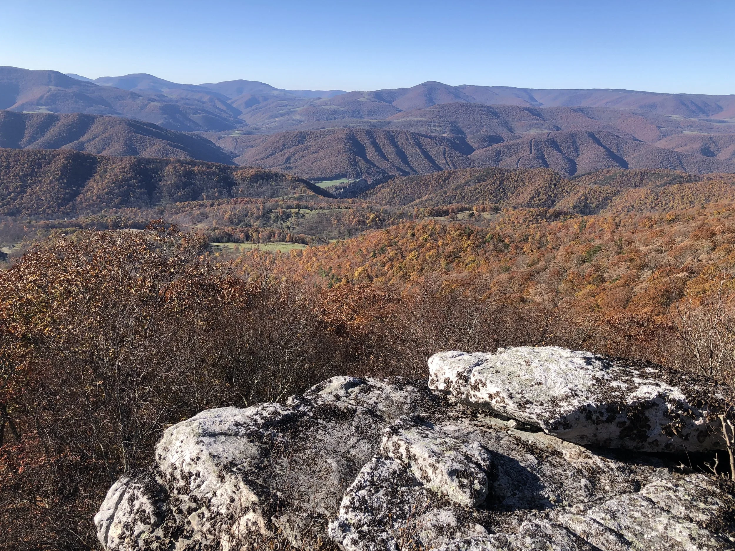
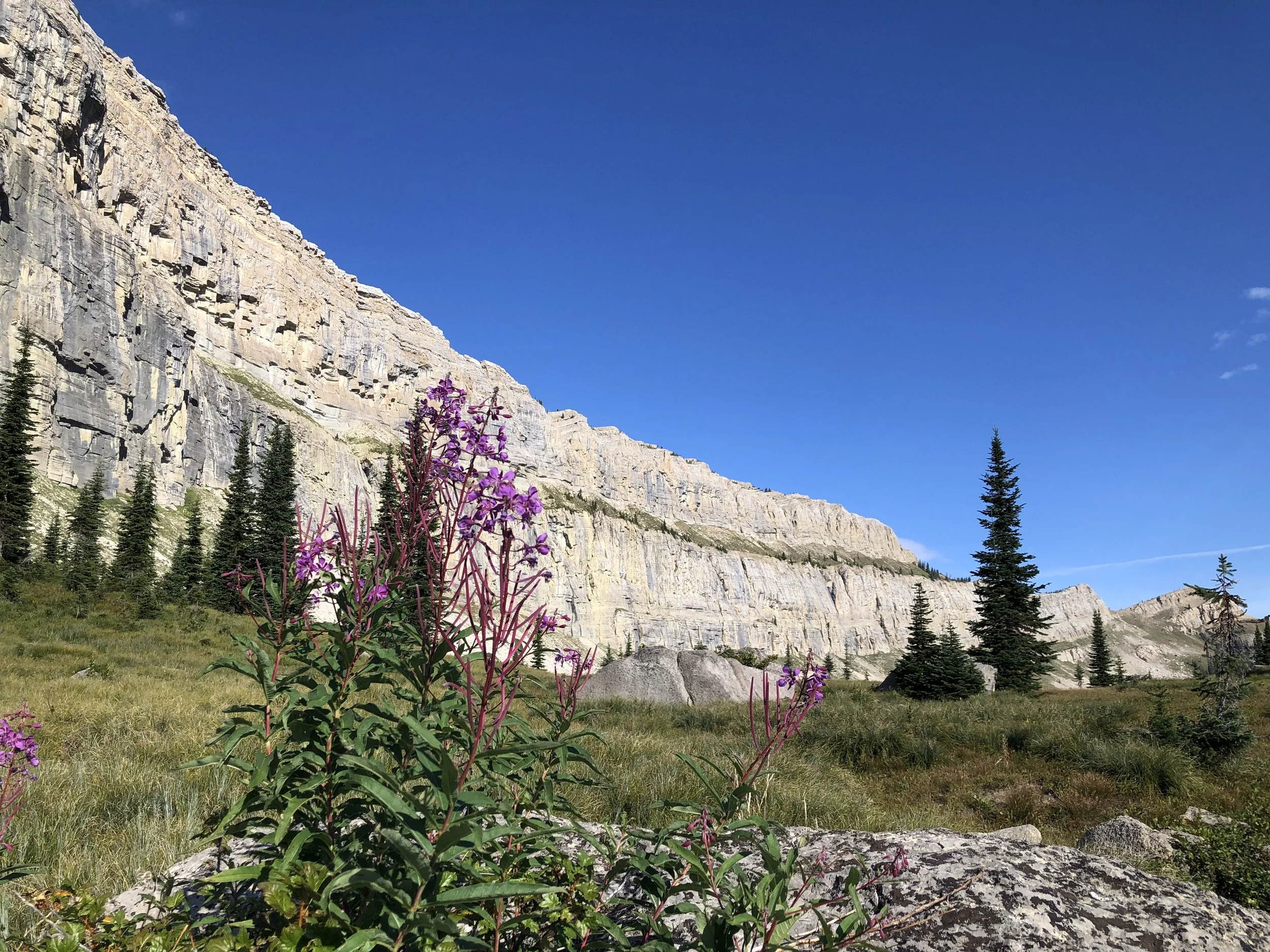
North Fork Mountain Trail
November 2021, 24.7 miles
-
Looking south along Tuscarora escarpment
Not far from Petersburg, WV, I parked my car along Smokehole Road and with a few days of rations, began my ascent toward Chimney Knob along the North Fork Trail. Unseasonably mild November temps on this beautiful Sunday brought out many day hikers. Arriving at Chimney Rocks, I was afforded spectacular views across the breathtaking southeast limb outcrop expression of Wills Mountain Anticline.
-
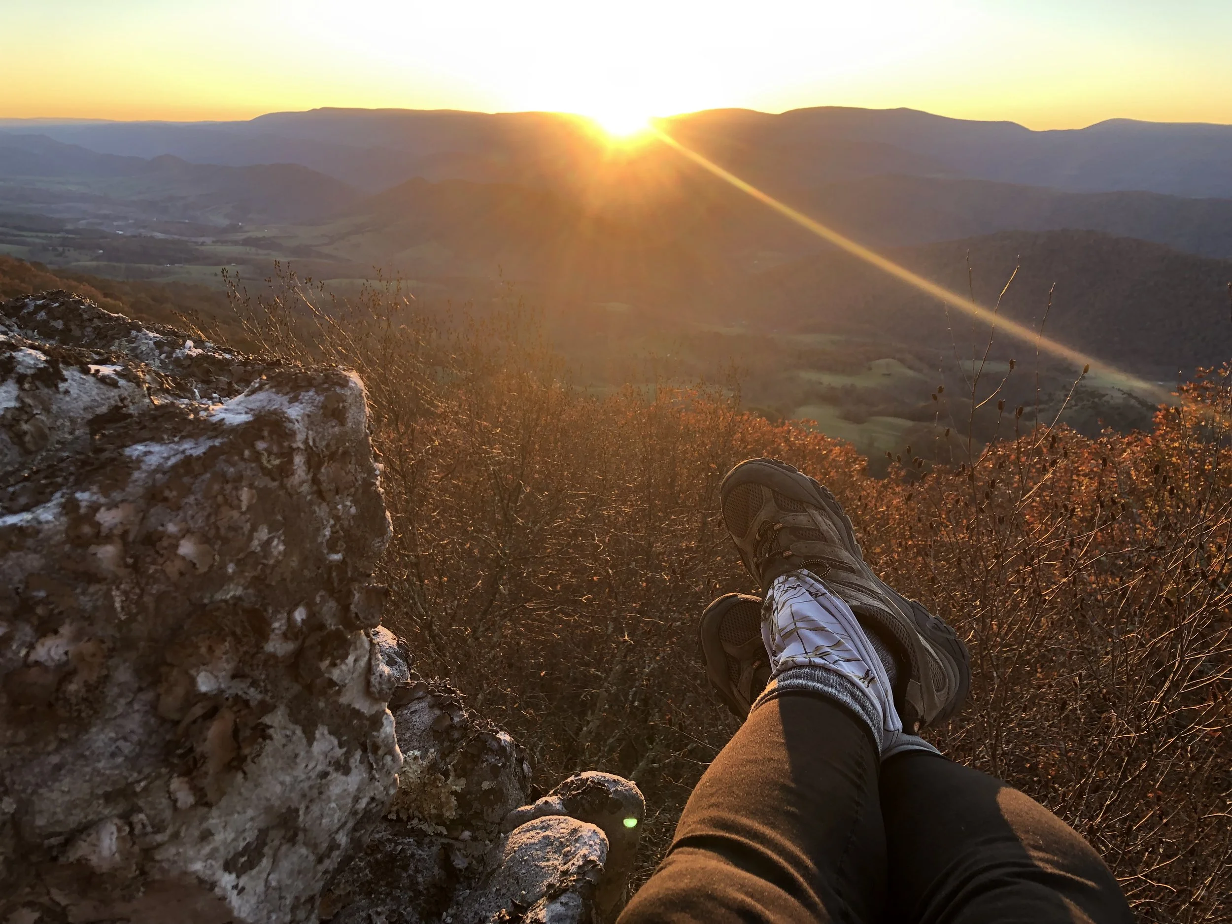
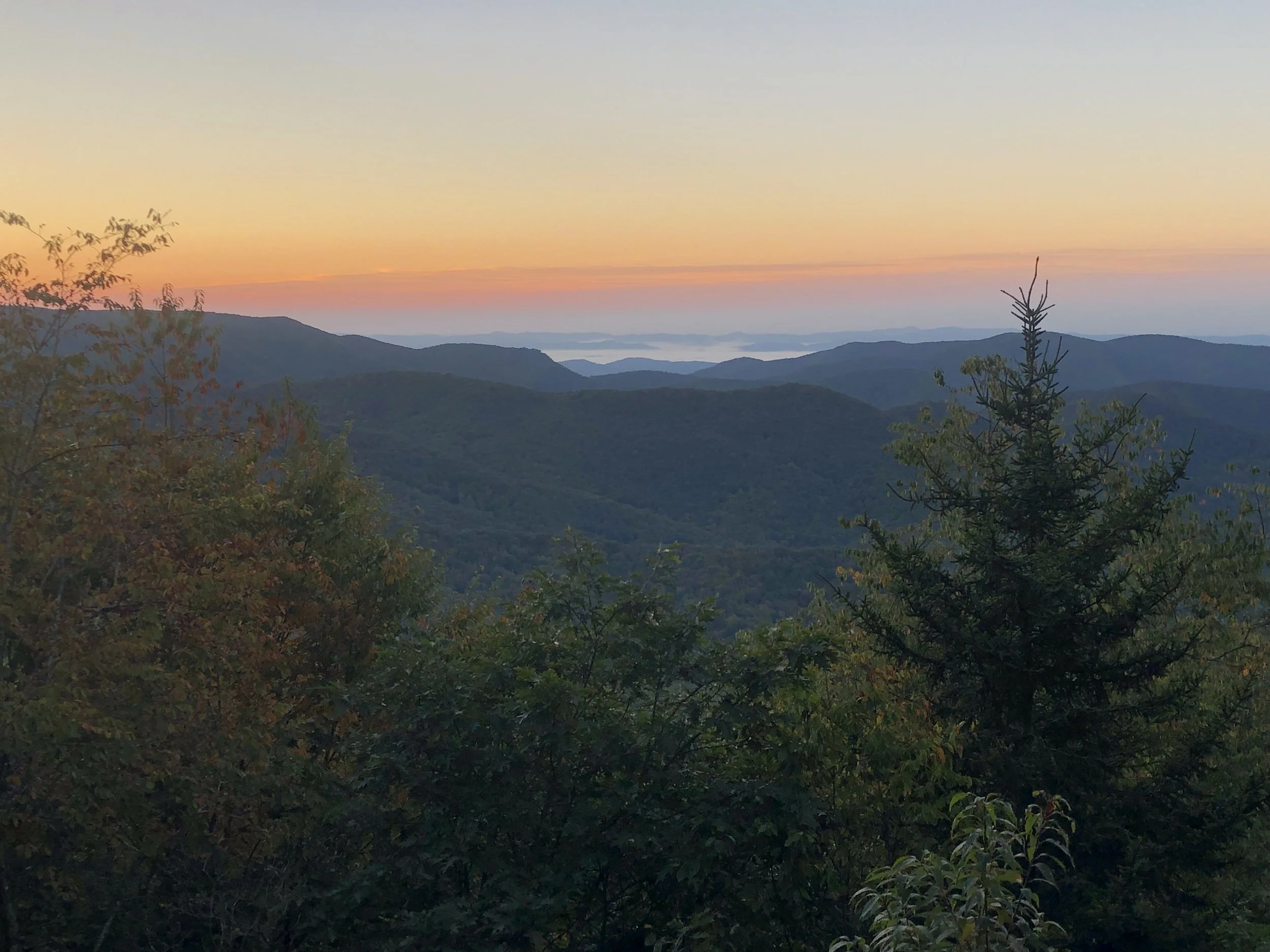
Gazing west toward the slowly setting sun behind Spruce Knob
Perched upon the gently dipping Tuscarora ledges, I enjoyed the solitude of a chilly November evening. While boiling water for my ramen noodles, I watched the sun slowly setting behind the Allegheny Front and farther off in the distance, Spruce Knob. In the darkening sky to my left was a crescent moon and two evening stars.
-
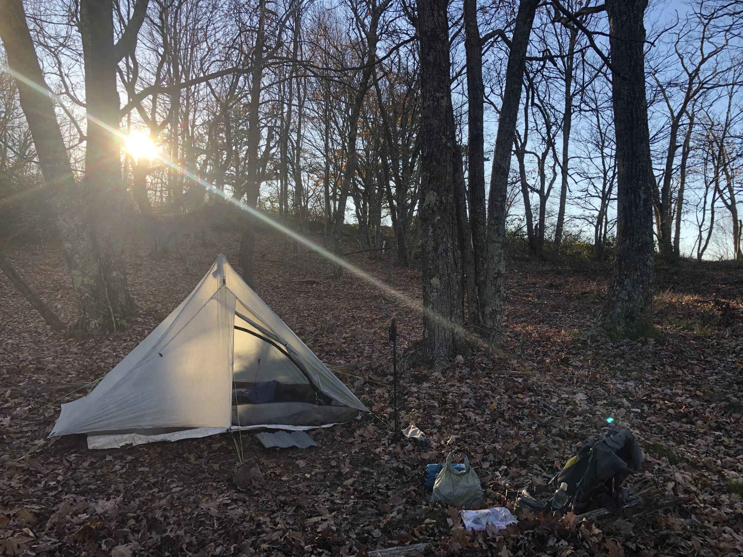
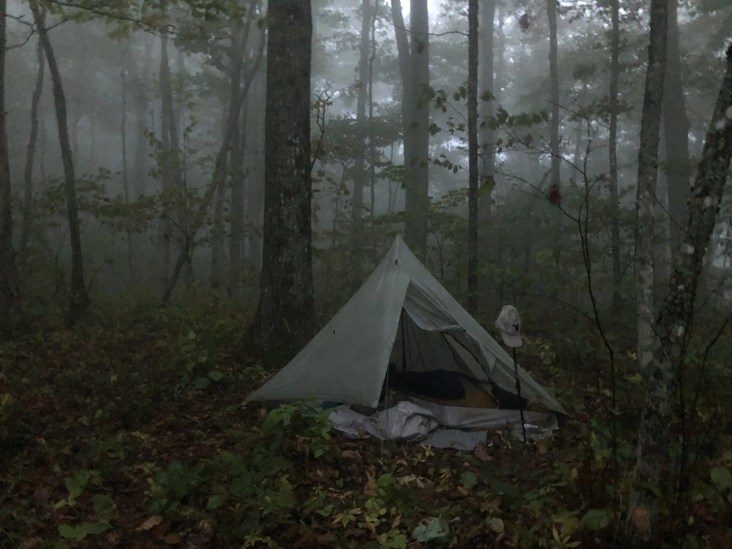
Camping near the edge of the Tuscarora escarpment
Each night I was able to hand pick a campsite near the cliffs where the steady west wind could be heard and felt throughout the night. Clear skies and near zero light-pollution allowed for unparalleled stargazing. Lying in the warmth of my goose down bag, I was mesmerized by the Milky Way painting its path across the heavens above me.
-
Looking northwest across Germany Valley toward Seneca Rocks and the Allegheny Front
The Cambro-ordovician limestone core of the eroded Wills Mountain anticline (WMA) was settled by immigrants from Germany searching for fertile farmland. The valley is bounded on the northwest by the River Knobs, the geomorphic expression of the steeply dipping leading limb of WMA. Seneca Rocks can be seen along this ridge line at Roy Gap. Northwest from these knobs, all beds become progressively younger toward the Allegheny Front, where Pennsylvanian Pottsville sandstone and its equivalents cap the Allegheny Front near Dolly Sods.
Foothills Trail, SC
April 2022, 77 miles
-
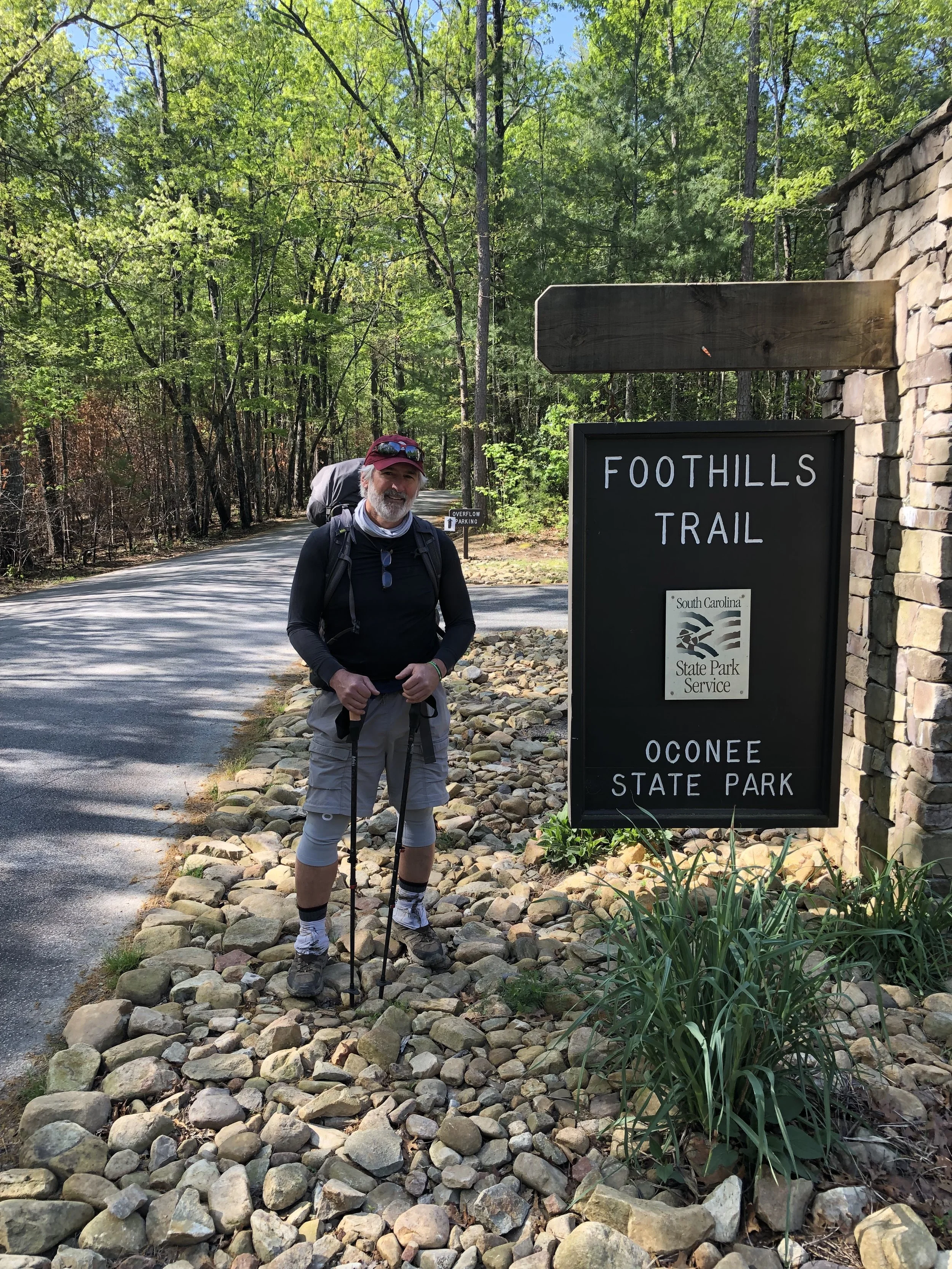
Starting at western terminus
After a one hour shuttle from my car left at Table Rock State Park near Greenville, SC, I began my trek at Oconee State Park about 10am on Monday morning. My original expectation was to hike about 15 miles each day, ending after five days on the trail, back at Table Rock. I was beginning and ending in Blue Ridge metamorphic rocks, mostly schists, with some gneisses and some metasediments. Several high peaks along the way are plutonic rocks emplaced during Taconian time, and then later metamorphosed to gneiss.
-
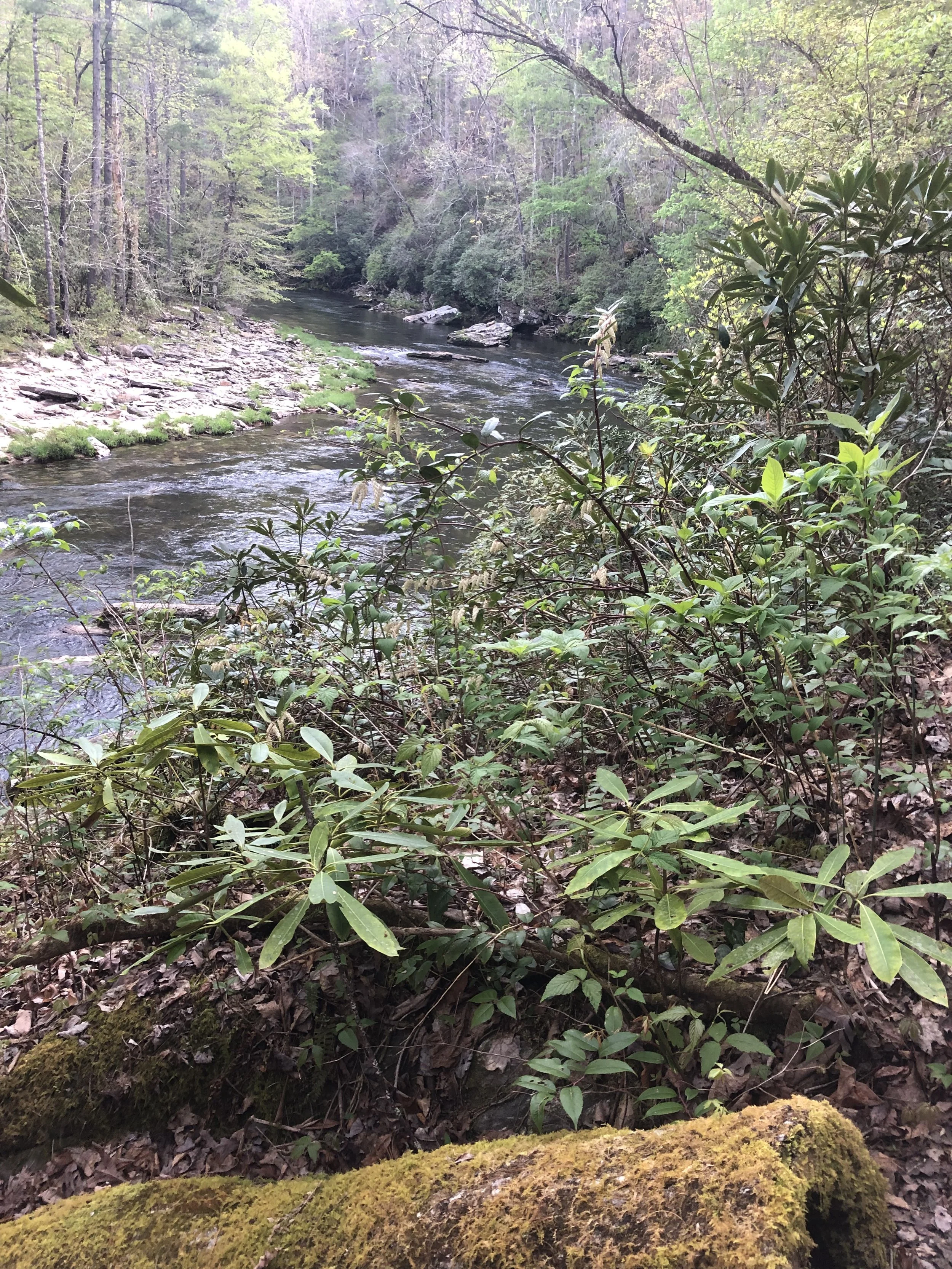
First couple of days were easy riverside trails
Beginning the trail I was on smooth, gently graded and even footpath often following streams and rivers. I passed by beautiful rapids and waterfalls with abundant water supply and opportunity to fish for those so inclined. The trail became increasingly difficult on Day 3, leading me in and out of the steep gorges along this trek. Following two consecutive 15 mile days, I decided on the 3rd day after only 11 miles to cut back my daily miles and extent my journey to 6 days, thus allowing more time to enjoy the beauty and serenity magical place.
-
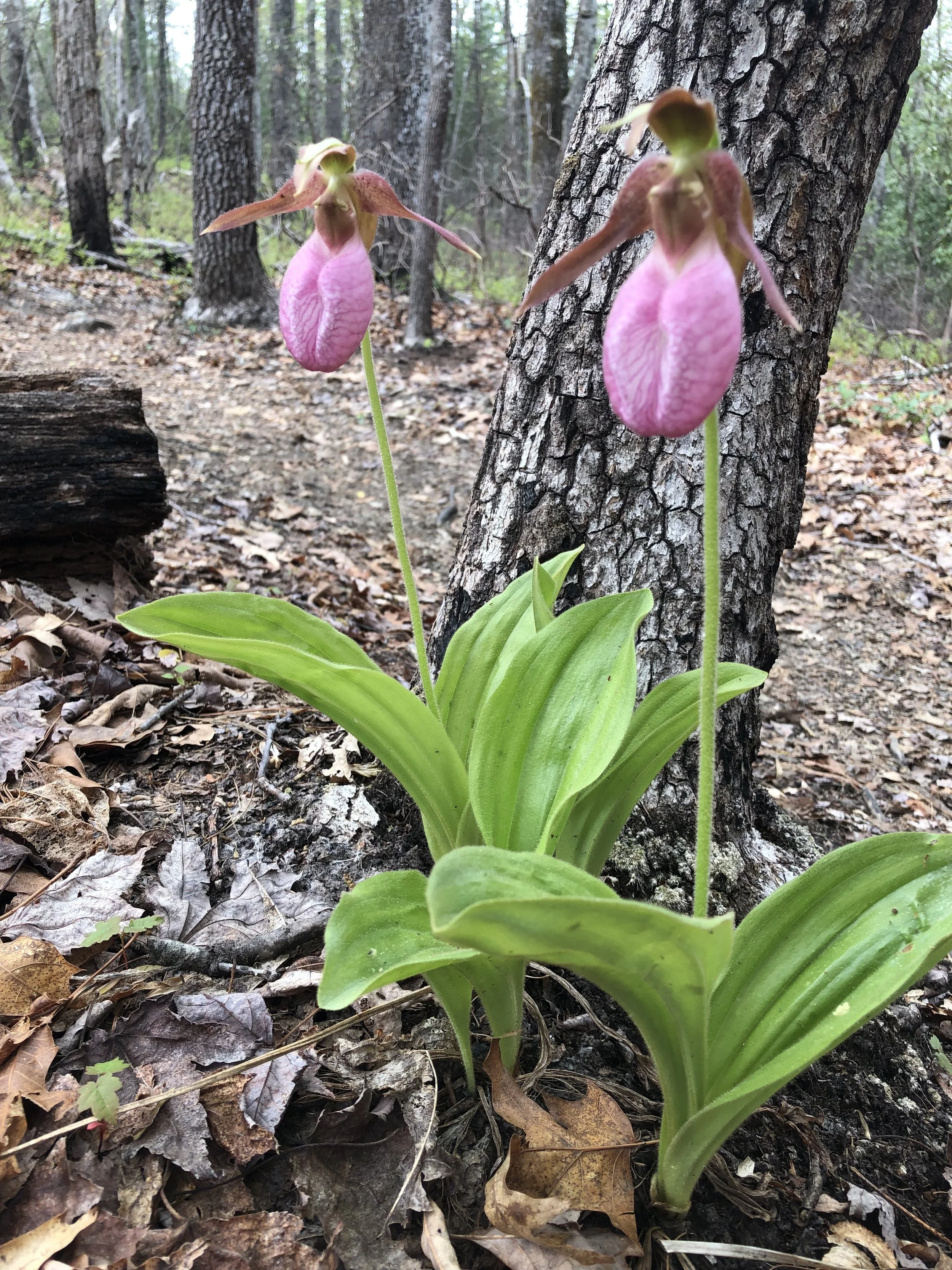
Perfect time of year for wildflowers
All along the trail were pink, deep red (vaseyi) and yellow Trillium, wild iris, and the rare but occasionally seen pink Lady’s Slipper. With so much of the bedrock fine grained metasediments and platy schists, the terrain and trail conditions remained mild, only occasionally interrupted by brief periods of steep ascents and descents into the frequent deep gorges. Narrow trails following the contours or ridge lines took me past the myriad waterfalls and turbulent streams far below me. A single misstep could send me sliding down the near vertical hillside into the abyss from which I can’t imaging how anyone would find a way to emerge.
-
Waterfalls at every turn along the trail
Nearing the end of my six-day adventure through this untamed forest of deep gorges, myriad waterfalls, bridges, steep stair steps and occasional magnificent vistas, I camped on the 2nd last night at the top of Laurel Fork Falls. I set up my tent about 10 yards away from the top of this 80 foot cascade of rushing water down to the awaiting Lake Jocassee. The final two days took me up hundreds of steps along the ascent to Sassafras Mountain, the highest point in South Carolina. After passing several more breathtaking vistas, i ended my journey in the parking lot of Table Rock State Park at around noon on Saturday.
Colorado Trail
August - September 2022, 486 miles
-
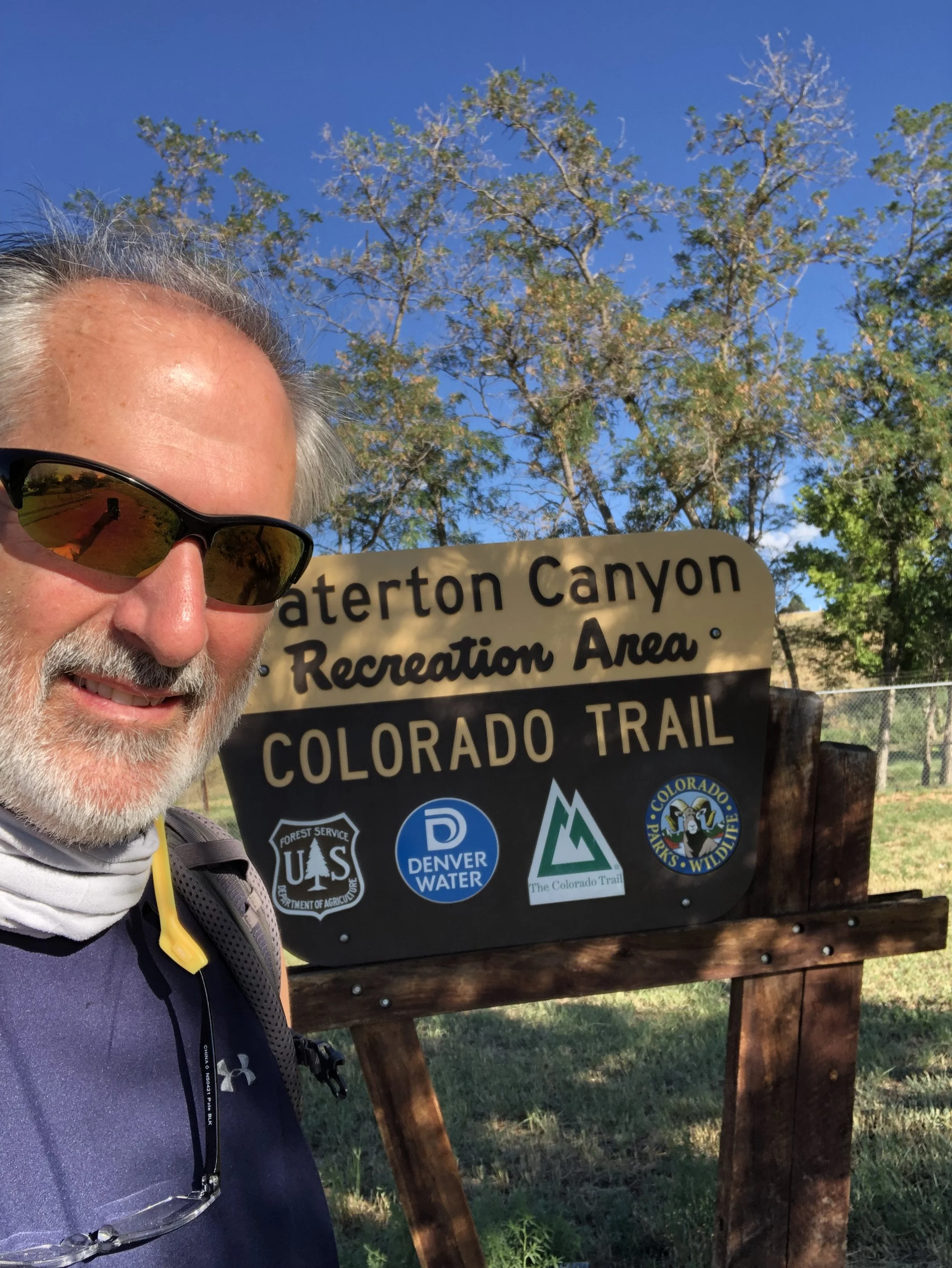
Eastern terminus near Denver
Beginning the trail at just over 5500’ elevation along Denver area’s Waterton Canyon, I was able to easily acclimate to the altitudes of the Rocky Mountains. By day three i was above 10000’ and by the end of the first week I had surpassed 12,500’ while crossing over Tenmile Range between Breckenridge and Copper Mountain. Bedrock under foot was paleoproterozoic age foliated gneiss and schist. Days later I transitioned into the pinkish-red granite of the Pike’s Peak batholith.
-
Staying above treeline
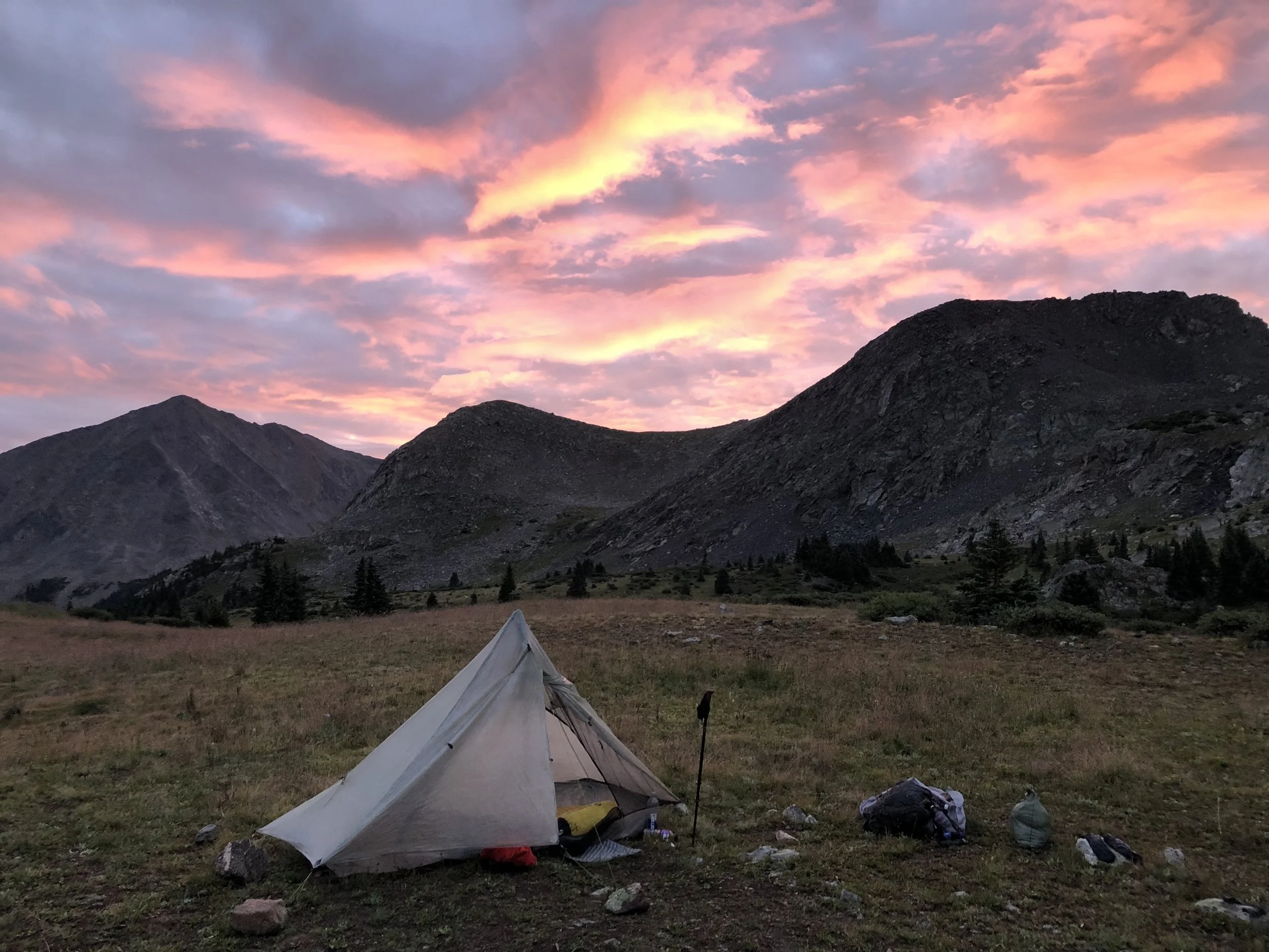
Each day brought with it new and exciting challenges, always delivering beautiful vistas and rewarding views of where I had been and where i was going next. After an afternoon’s resupply at Twin Lakes I decided to take the western Collegiate route, where many days were spent above treeline, trekking across alpine meadows or over rocky barren passes. Several nights I camped on grassy knolls near glacial lakes within cirques surrounded by majestic 14,000’ peaks. One such spot was Lake Ann, where I set up camp between downpours for the evening, while watching a herd of snow-white mountain goats navigating the rocky cliffs above me.
-

Following the CDT for 314 miles
Of the 486 miles traveled on this beautiful trail, 314 miles of it follow the Continental Divide Trail along exposed ridge lines for tens of miles at a time. In addition to the spectacular views and the abundance of exposed bedrock, perhaps what amazed me the most was how few signs of civilization could be seen from the trail. Another surprise was the pervasiveness of the devastation of the old growth pine forests due to the pine bark beetle. Massive efforts to cut and thin forests have been underway for decades now, and the destruction caused by these bugs to the western forests was truly shocking.
-

San Juan Mountains and Elk Creek Gorge
The last 10 days or so before reaching Durango I spent trekking through the majestic San Juan Mountains of southwestern Colorado. The bedrock here ranged from 32 Ma volcanics (andesite lava flows, ash flows and breccias) to 300 Ma sandstones and shales of the Paradox sedimentary Basin. After an incredible day of exploring the Weminuche Wilderness, the trail split sending CTD hikers south toward NM, and sending Colorado Trail hikers west toward the Elk Creek Gorge.
Mountains to Sea Trail:
Table Rock to Mt. Mitchell, NC
April 2023 - 50 miles
-
Beginning the ascent to Table Rock
Proterozoic metasediment thrusted over top Cambrian age Quartzites of the Conecocheague form the bedrock at Table Rock Mountain. These older rocks of the remnant Table rock thrust sheet are surrounded by younger rocks of the Grandfather Mountain window.
-
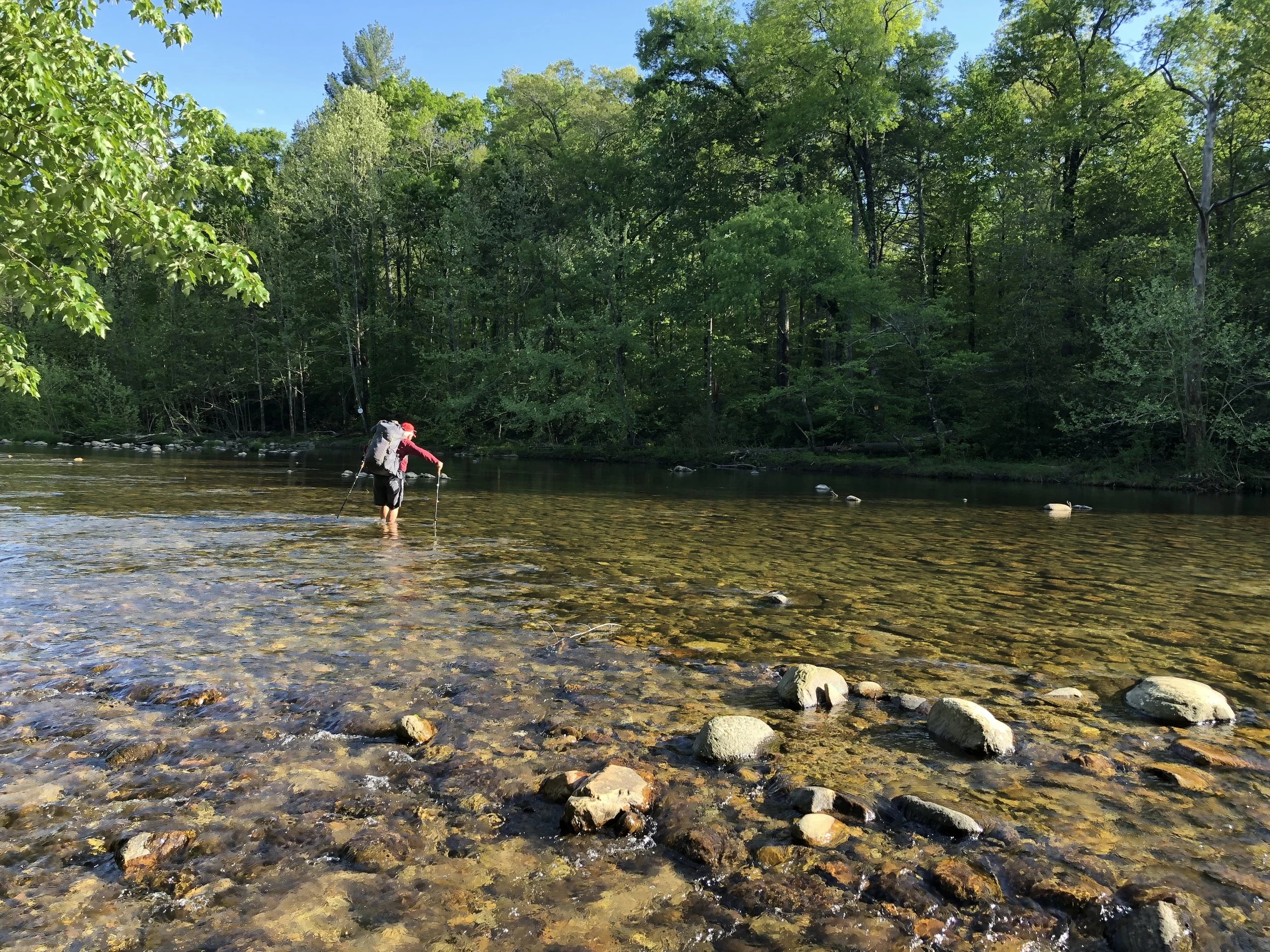
Fording the Linville River
Hiking the quartzite escarpment along Shortoff Mountain afforded spectacular views across the canyon to the far ridge lines. The highland trail eventually yielded to a long descent into the mouth of the Linville Gorge. Before making camp, we changed into our water shoes and crossed the cool, shallow water of the Linville River. On the other side we found a large open area for our camp for the night.
-
Looking back to Table Rock from Bald Knob
Hiking over Bald Knob’s quartzite ridges afforded spectacular views of Black Mountains to the northwest and the peaks of Table Rock and Shortoff Mountain to the east. The hike down Bald Knob was a series of long well graded switchbacks allowing for frequent views of Black Mountains and Mt Mitchell.
-
The last few steps before arriving at Mt Mitchell summit
On the final day we began our 3684 foot vertical ascent over 6 miles to the summit of Mt Mitchell. Dense forests of Firs and Red Spruce are found here, similar to the forests of Maine. At 6684 feet, Mt Mitchell is the highest point east of the Mississippi River.
Alta Via 1, Dolomites, Italy
June 2023 - 63 miles
-
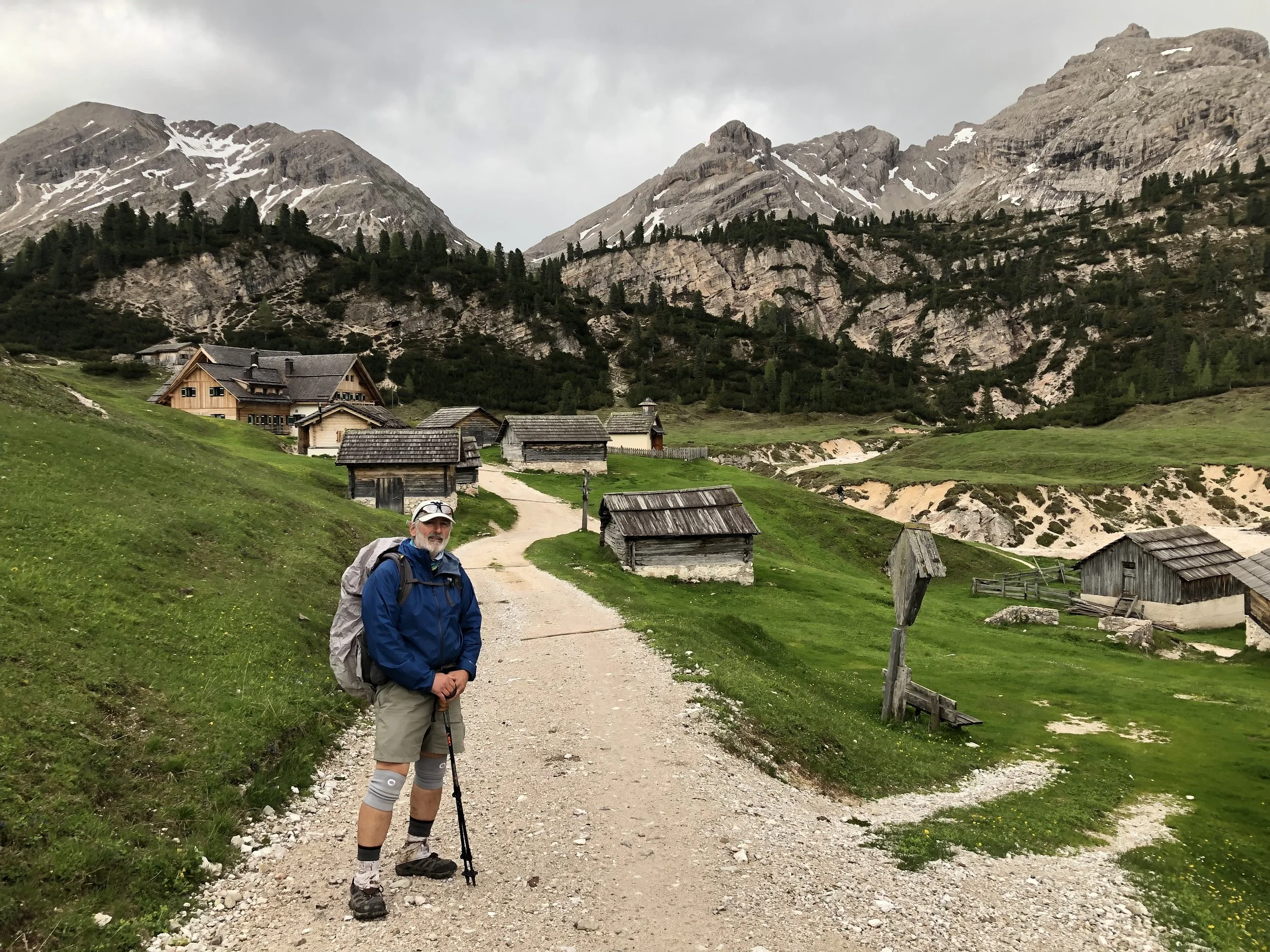
On way to Rifugio Fedora Vedra for night stay
Early on during my nine day trek through the Italian Alps known as the Dolomites I passed through several small settlements and old farm communities surrounded by the ever present back drop of the Dolomite mountains.
-
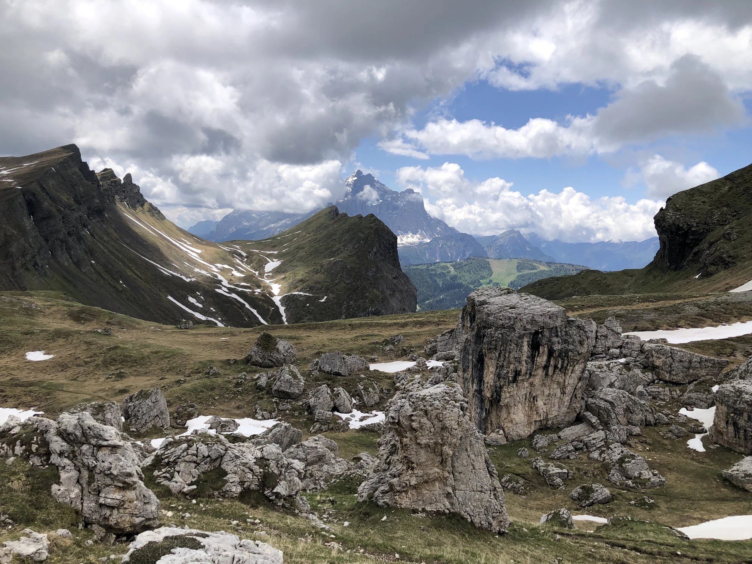
Taking in the spectacular views from atop Lavinores
Following a grueling 90 minute ascent to the top of Lavinores (2462m/8077ft). I was rewarded with stunning views in all directions while settling in for a late lunch break. Most of the rocks comprising these mountains are limestones and dolomites, once part of a vast ocean basin of Triassic age about 230 million years ago. The glacially scoured valley to the west would be my destination for the night.
-
Beautifully sculpted landforms resulting from Alpine Orogeny
Beginning about 65 million years ago, the Alpine orogeny occurred as result of collisions of European and African tectonic plates. This collisional event caused thrusting and folding of the carbonate rock layers resulting in the spectacular topography present today in the Dolomites.
-
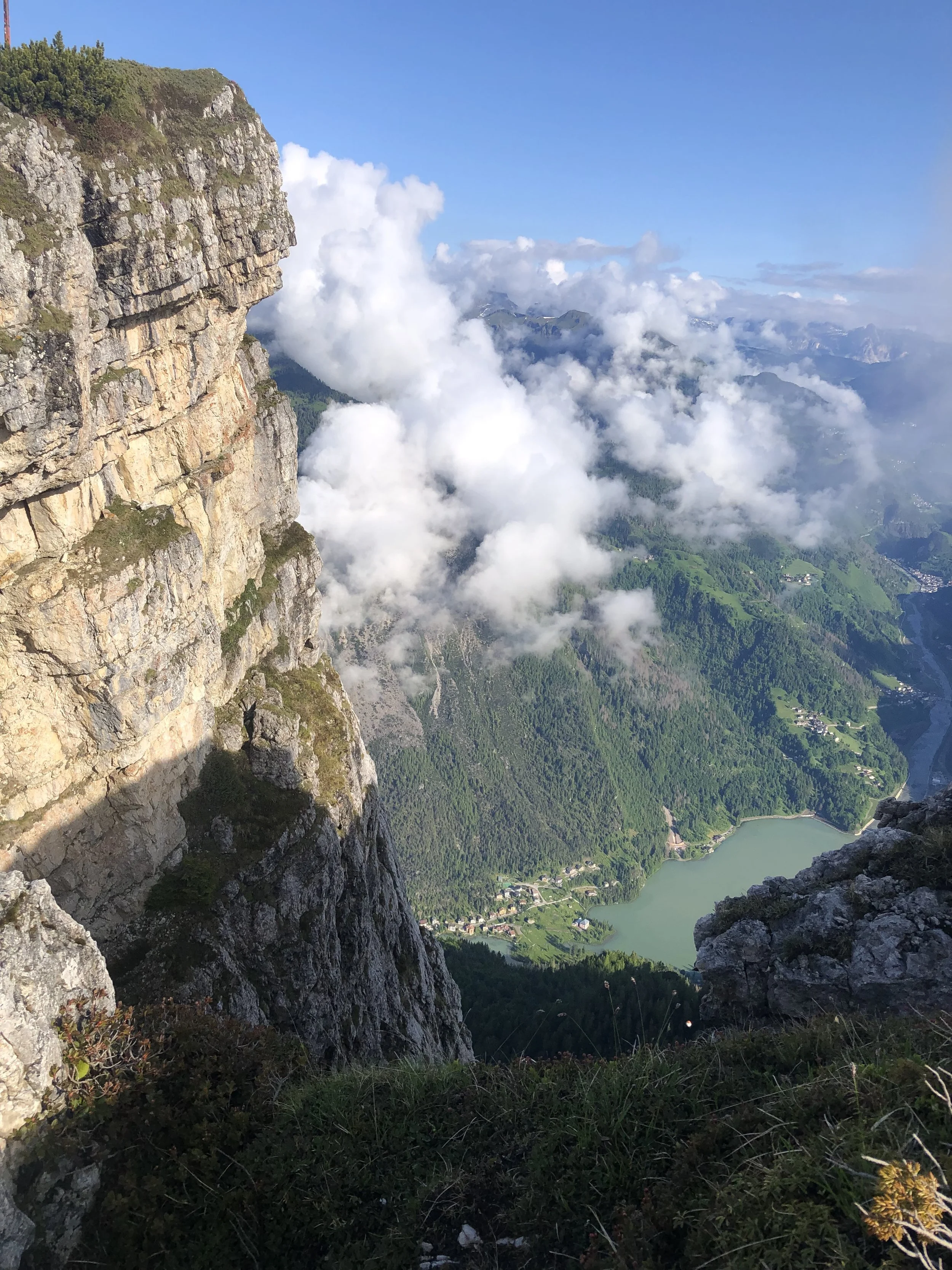
Peering into the Lac d'Alleghe from Rifugio Tissi
The dolomites are well known for their incredible steepness and towering spires of carbonate rocks jutting skyward from lush green valleys. A short 5 minute walk from the 7382 ft Rifugio Tissi perched atop one of these spires reveals the breath taking view into the valley far below.
Adirondacks High Peaks Region, NY
August 2023 - 22 miles
-
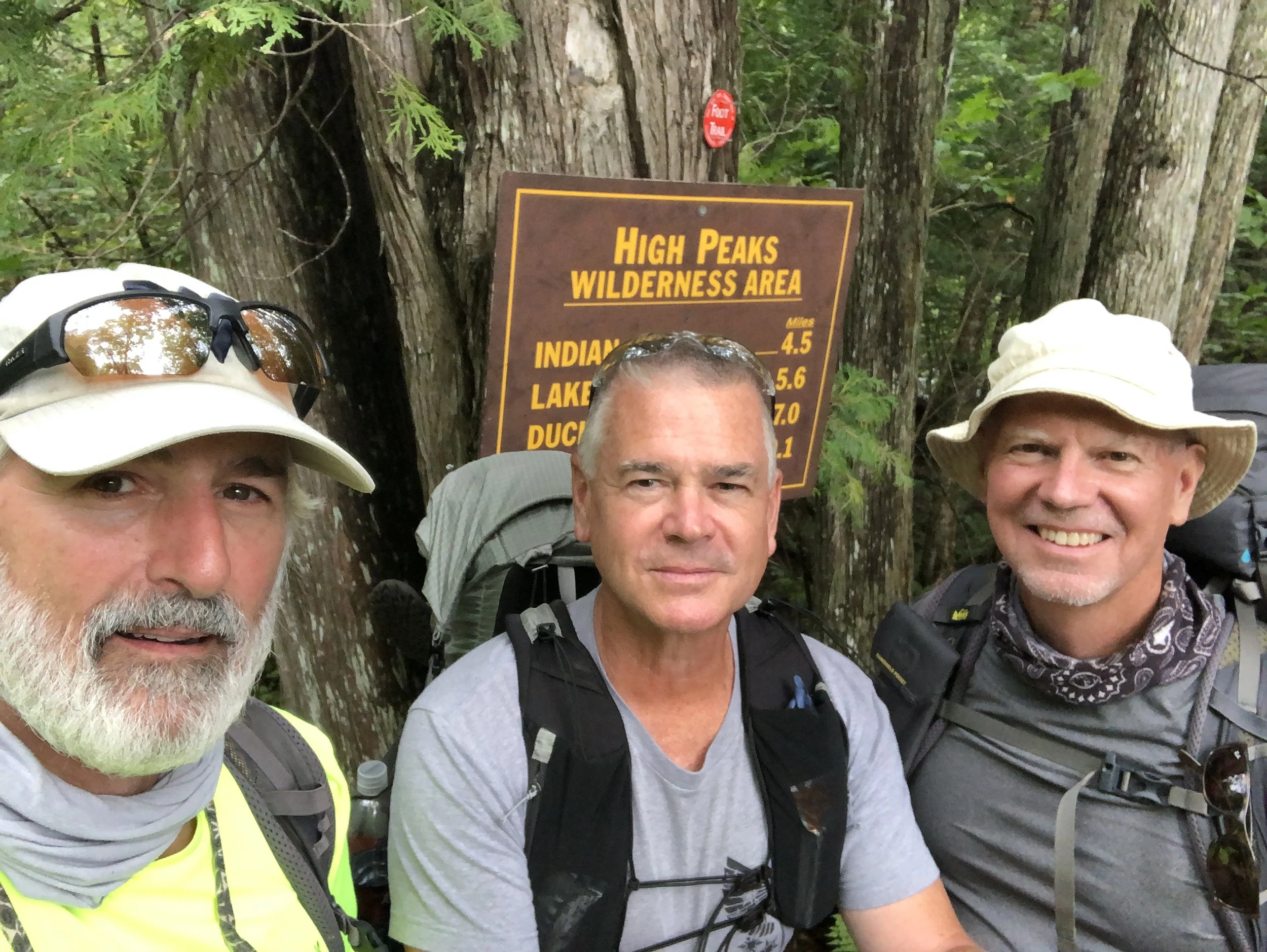
Near trail head at Upper Works lot east of Henderson Lake
Forty-four years ago, I set out on this same journey with these same two friends: brothers Bruce and Brad. Bruce and I have been friends since high school having hiked together in the Adirondacks and Shenandoahs during our college years. Our plan for this week was to follow in our previous footsteps to the same high peaks we had conquered so many years ago. The trails were the same but to us they seemed much more difficult than we remembered.
-

Our hike into camp on the first evening along Calamity Brook
The Calamity Brook trail was a good introduction into the conditions that we would be faced with for the next several days. Rugged and beautiful, all of the rocks exposed here were billion year old metamorphics of the Grenville orogeny as the super continent of Rodinia was slowly being assembled. These rocks are part of the basement complex and had been covered by sedimentary rocks of the Appalachian basin for several hundred million years. Uplifting of the Adirondack dome during the late Tertiary period, roughly 20 million years ago, brought these basement rocks once again to the surface.
-
Beautiful river valleys and gorges sculpted from Pleistocene glaciation and meltwater
After crossing the Opalescent River, we began our long uphill journey toward Lake Tear of the Clouds. Following an unseasonably wet summer, all the trails near rivers and ponds were flooded, making for slow and difficult travel. During our trek along these rocky foot paths, we had the opportunity to stop for many breathtaking views into the deep, glacially scoured gorges next to the trail. For the past 2.5 million years, repeated episodes of glaciation smoothed and etched the bedrock to form deep valleys pockmarked with lakes and ponds.
-
Atop Mt. Marcy, New York's highest peak at 5343'
After forty-four years, the three of us finally returned to the summit of Mt. Marcy. The rocks making up these mountains began as muds, silts and sands well over a billion years ago, and then through deep burial and repeated episodes of intense deformation, were transformed into a type of metamorphic rock known as anorthosite. Anorthosite is primarily composed of the mineral feldspar, with little or no quartz and only minor amounts of dark mafic minerals such as pyroxene and amphibole. Scanning the horizon in every direction, we could see evidence for the glacial scouring of these smoothly rounded peaks.
Mountains to Sea Trail:
Clingmans Dome to Asheville, NC
Sept. - Oct. 2023 - 125 miles
-
The initial descent from the Smokies
Three episodes of thrust faulting of the rocks originating from the Ocoee basin brought these metasediments to their present position in the Smokey Mountains. Beginning at some of the highest peaks in the Smokies, the Fork Ridge trail abruptly plunges 3000 vertical feet into the Deep Creek Valley over the course of the next 6 miles. Over the next 10 days of my solo trek I encountered more bears (4) than MST backpackers (2). While hiking near other popular trails such as Art Loeb or Blue Ridge Parkway loop trails, I did see other, mostly day-hikers.
-
Abundant spectacular views
The MST follows ridgelines through the Smokies and Blue Ridge mountains, passing through Pisgah and Nantahala National Forests as well as unblazed wilderness areas such as Middle Prong Wilderness. Wildlife abounds in these secluded areas creating a sense of connection with the natural ecosystem in my daily treks. Surprisingly well groomed and maintained trails with near horizontal grades over long distances were commonplace and much appreciated as I navigated my way through these majestic mountains.
-
Stealth camping was common in these remote highlands
Hiking all day over schist, gneiss and the occasional quartzite bedrock footpaths often required the use of stealth campsites at day end. After passing through GSMNP, designated campsites were few and far between. Several nights iI was required to carefully study the contours of the topographic maps to determine where a flat nose or gap near the trail might yield a suitably flat place to pitch my tent for the night. Only once did I experience steady rain overnight during my 10-day adventure.
-
Pastel sunset in Nantahala National Forest
Cool, breezy sunny days were followed by cold clear nights on these mile high trails. On many occasions I was treated to a full or near full moon overhead illuminating the forest for most of the night. One evening well after dark and while waiting for the moon to rise I was visited by a curious black bear foraging for acorns right outside my tent. Memories such as these will draw me back to the Blue Ridge Mountains again and again.
Mountains to Sea Trail:
Greentown Trailhead (Rt. 181) to Stone Mountain State Park, NC
April - May 2024 - 115 miles
-
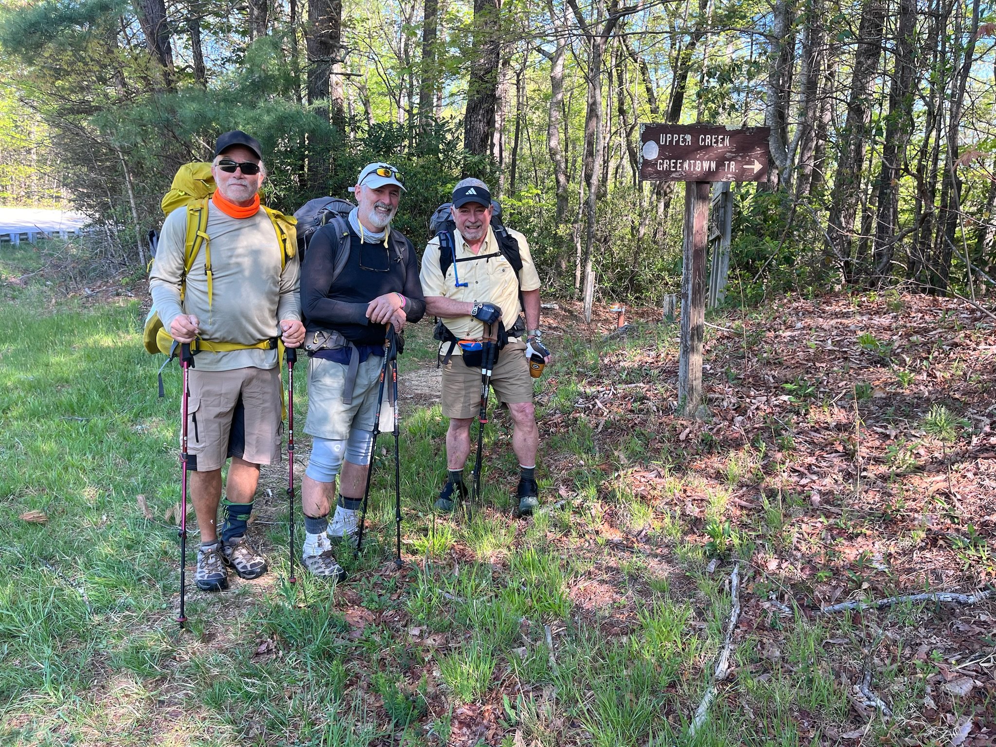
Beginning at Greentown Trail head on Rt. 181
A Wildcat, a Mountaineer and a Bulldog about to embark on a journey through Pisgah National Forest lands for the next couple of days. The trail would lead us past many waterfalls and clear trout streams, crossing a dozen times in cold, clear water sometimes over our knees. For the next 10 days we would travel 115 miles through the deep cut gorges of Harper Creek eventually leading past Grandfather Mountain and on to the Blue Ridge.
-
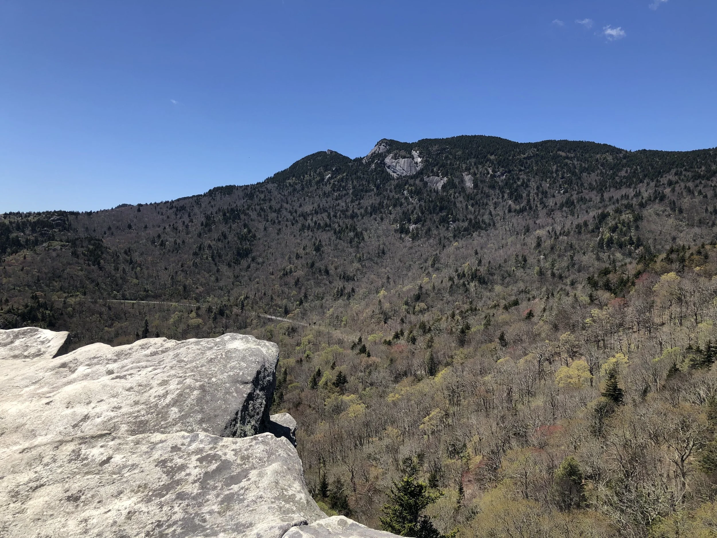
Great Views of Grandfather Mountain
After a grueling climb from the deep Valleys of Harper Creek onto the southern flanks of Grandfather Mountain the trail led us past Linnville Cove and up to the rocky ledges of Rough Ridge. Here we looked to the north onto the ridgeline of Grandfather Mountain just a few miles away. The northwest vergent metamorphics are part of a series of thrust fault slices exposing younger rocks of the Grandfather Mountain window.
-
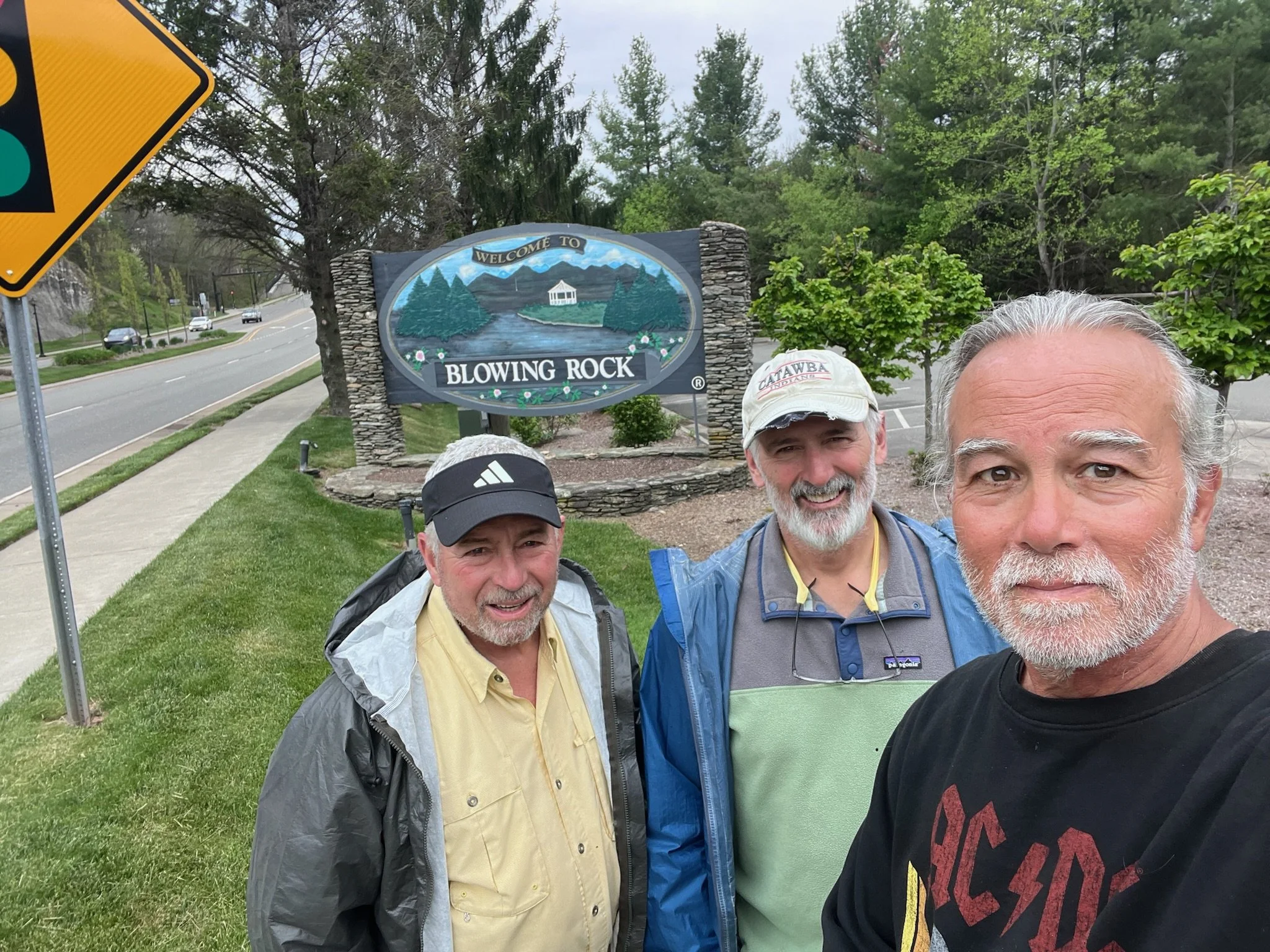
After five tough days we sought reguge for a night in Blowing Rock at the Cliff Dwellers Inn
A night at the Cliff Dweller’s Inn was a needed break after five surprisingly difficult days of stream crossings, relentlessly long hill climbs and boulder scrambles. We treated ourselves to some real food for dinner that night and breakfast the next morning before venturing off to the northeast along the Blue Ridge.
-
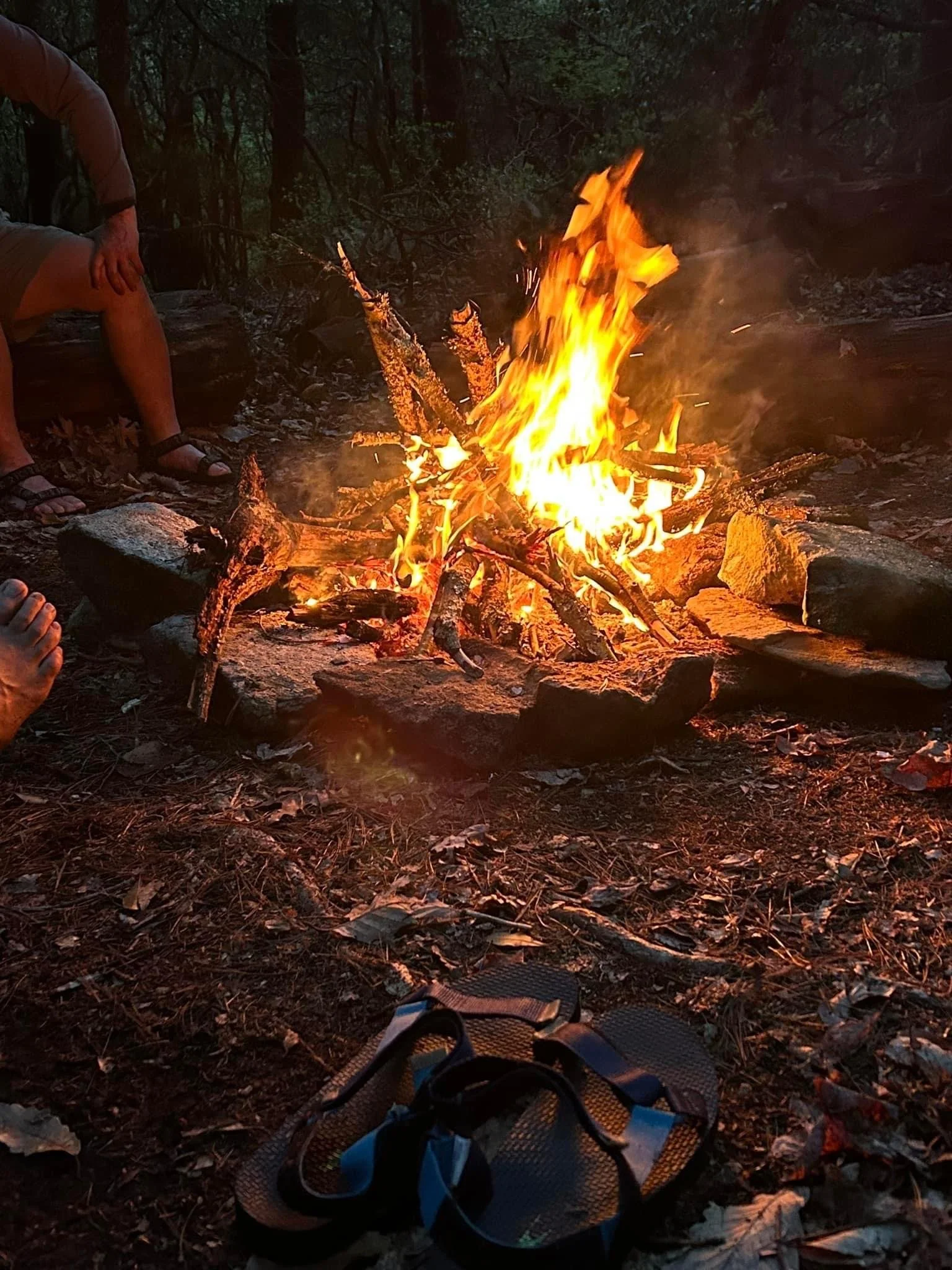
Perfect way to end another day in the Blue Ridge
Because so much of the mountains segments of the MST are on National Park Service lands, very few campsites are available. Some of our campsites were reserved in advance to ensure their availability upon arrival, and some were private campgrounds short distances off the trail. Many nights we made our ramen or dehydrated dinners while relaxing around a crackling campfire as the sun slowly set for the day.
Continental Divide Trail:
Waterton Park, CA to Butte, MT USA
Aug-Sept 2024 - 400 miles
-
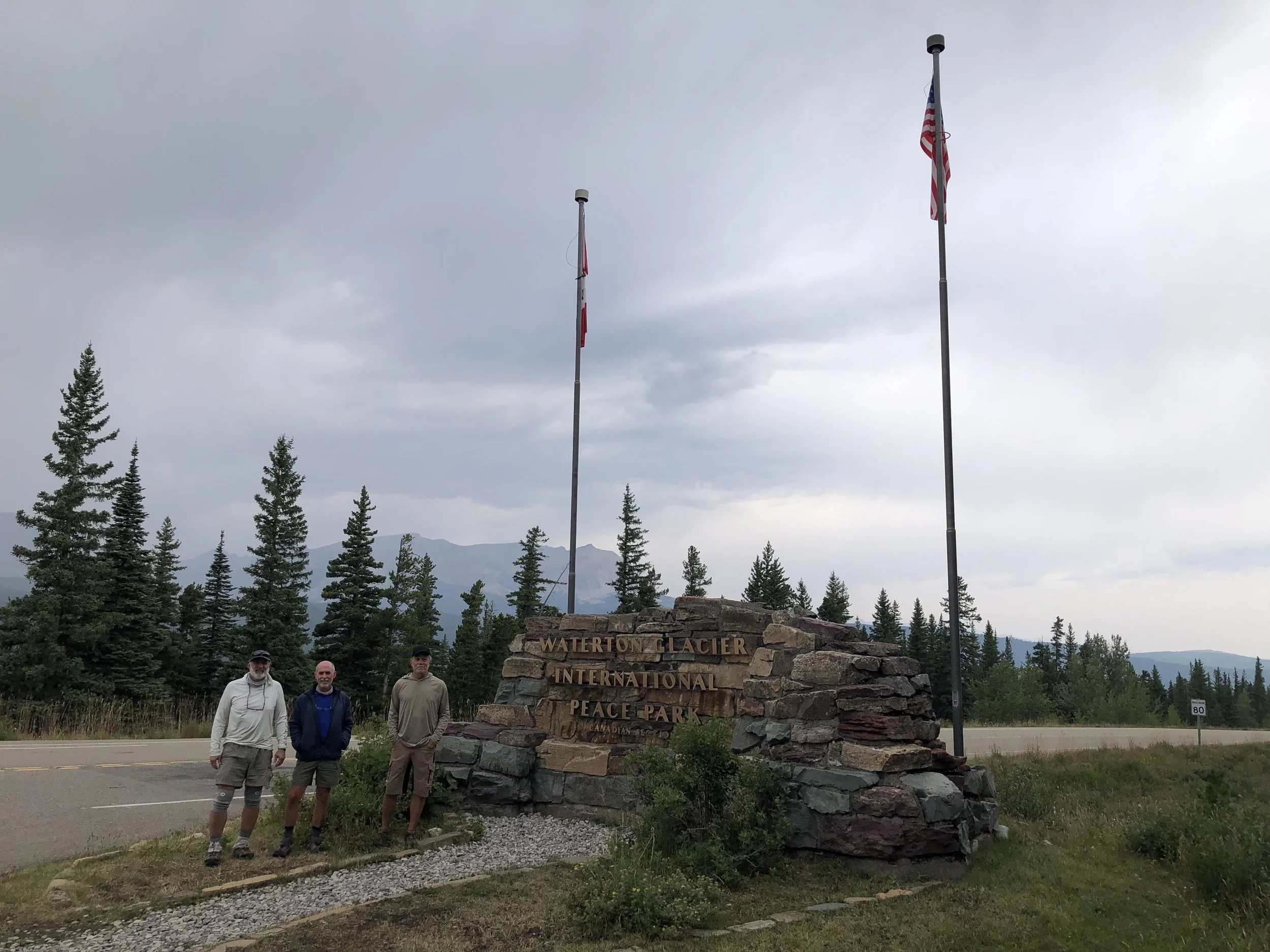
Beginning at Chief Mountain border crossing US-CA
A Wildcat and 2 Mountaineers about to embark on a journey through Glacier National Park and beyond for the next couple of weeks. On our way tp Waterton Park and CDT northern terminus trailhead via Dave's shuttle. Dave is a native Blackfoot descendant whose ancestors once thrived in the lands now known as Glacier NP. Situated in the Sevier fold and trust belt we begin our southbound trek in Canada along the shoreline of Waterton Lake as it leads us across the border and into Glacier NP in northern Montana.
-
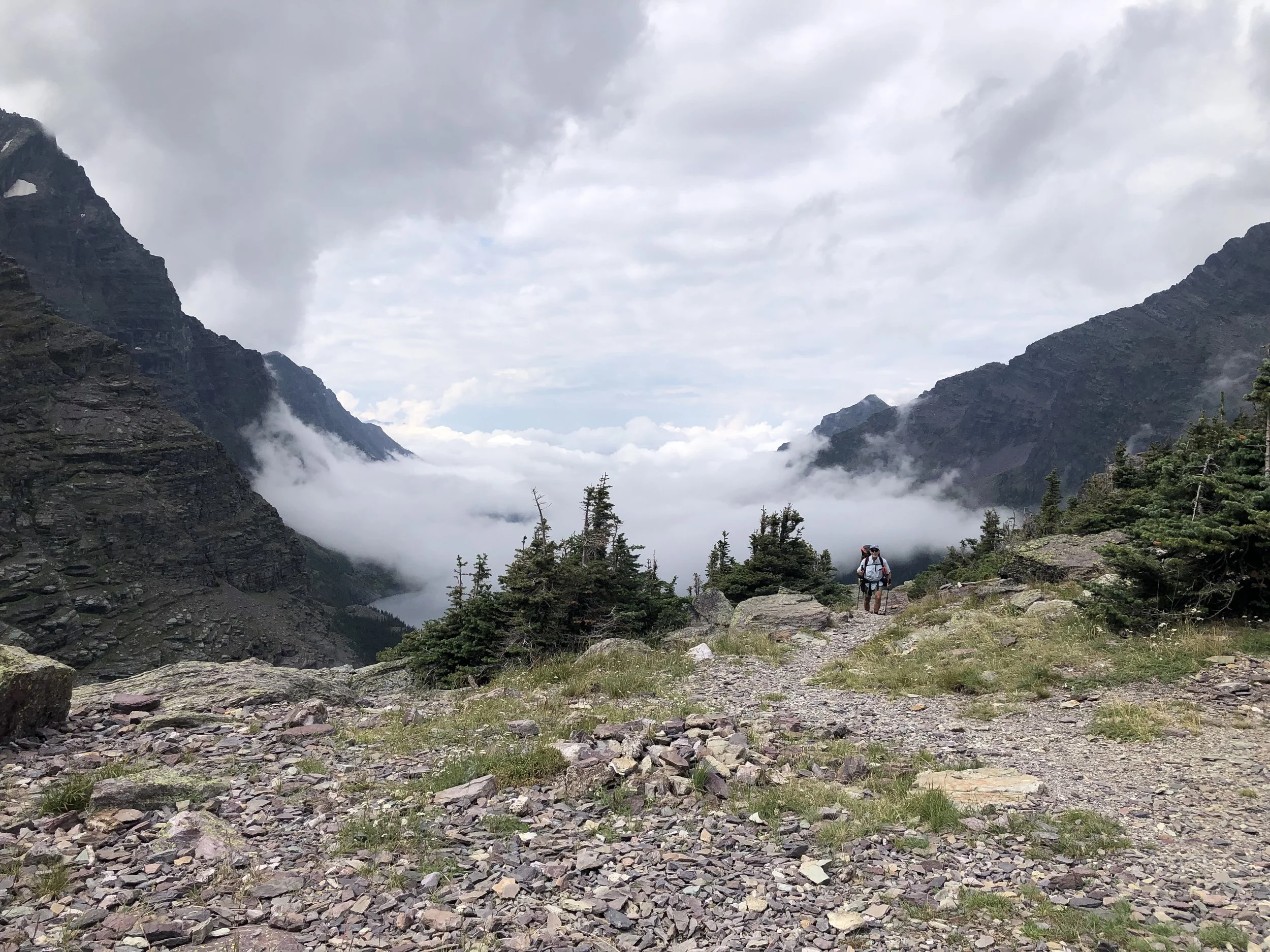
Arriving at the top of Gunsight Pass amidst the morning fog
Rising from the alpine valley below gunsight pass, the early morning fog slowly rises to reveal the spectacular geology and resulting glacial landforms found throughout Glacier NP. One and a half billion year old maroon sandstones and lithic arenites cap many of these high mountain peaks. Only accessible by long distance backpackers, we considered ourselves fortunate to be able to witness the ever-changing beauty surrounding us on this cool August morning.
-
South of Glacier NP we enter the Bob Marshall Wilderness, locally known as "The Bob."
One of the most spectacular features seen in "The Bob" is the Chinese Wall. Extending north to south in a relatively straight line for over 10 km, the wall is the eroded eastern escarpment of a westward dipping low angle mesa comprised of Cambrian age white limestone and dolomite. We were told on several occasions that the problem bears from Glacier are sent to "The Bob."
-
Dry country along Continental Divide on Red Mountain
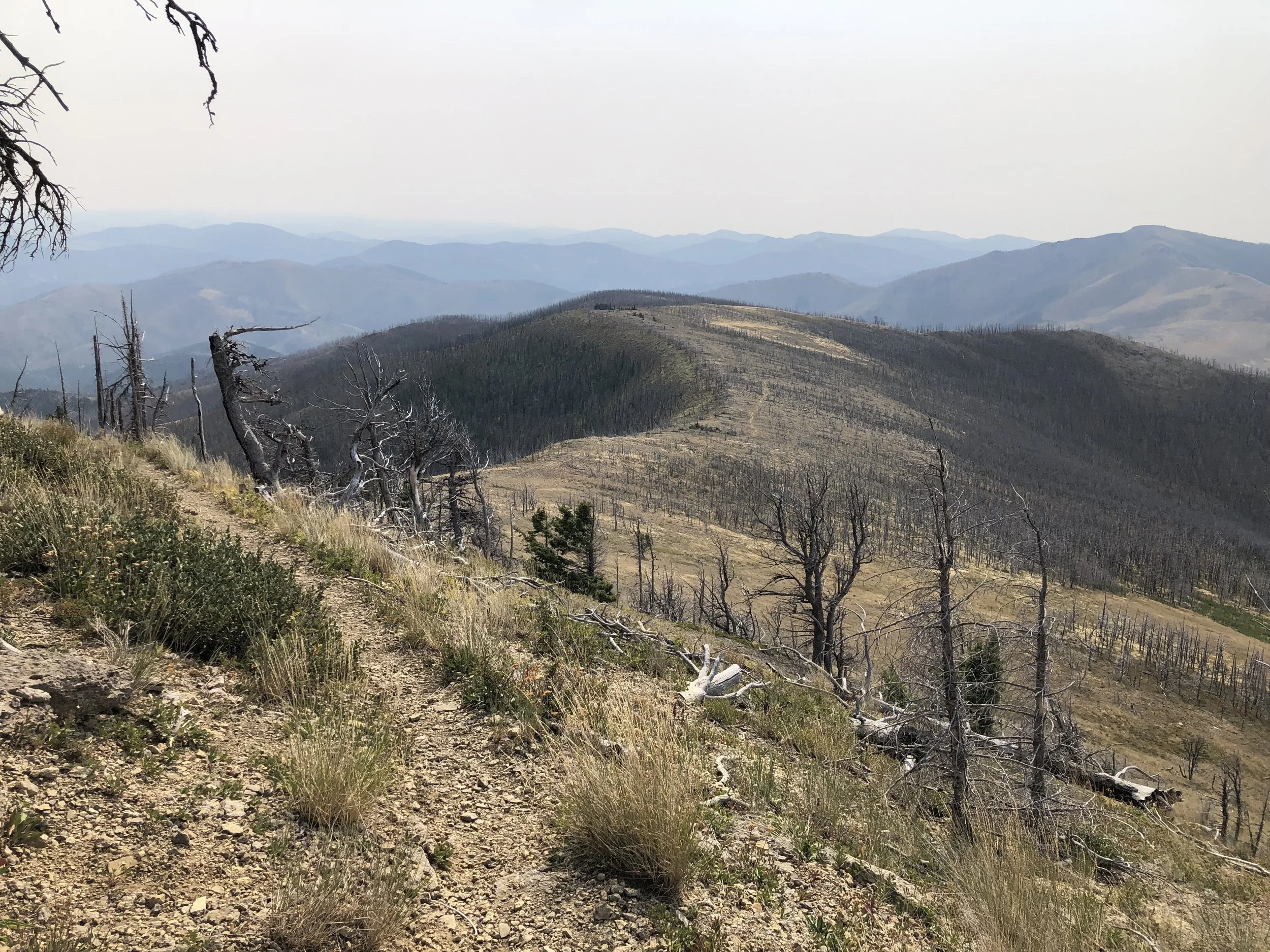
As I ventured southward, water became more scarce and many active wild fires near the trail caused closures and detours, sometimes for well over 20 miles to avoid the burn areas. My planned 500+ mile trek abruptly ended west of Butte when after 21 miles on the last leg of my journey, I encountered the Long Tom forest fire, turning me back and ending my 2024 CDT hike.
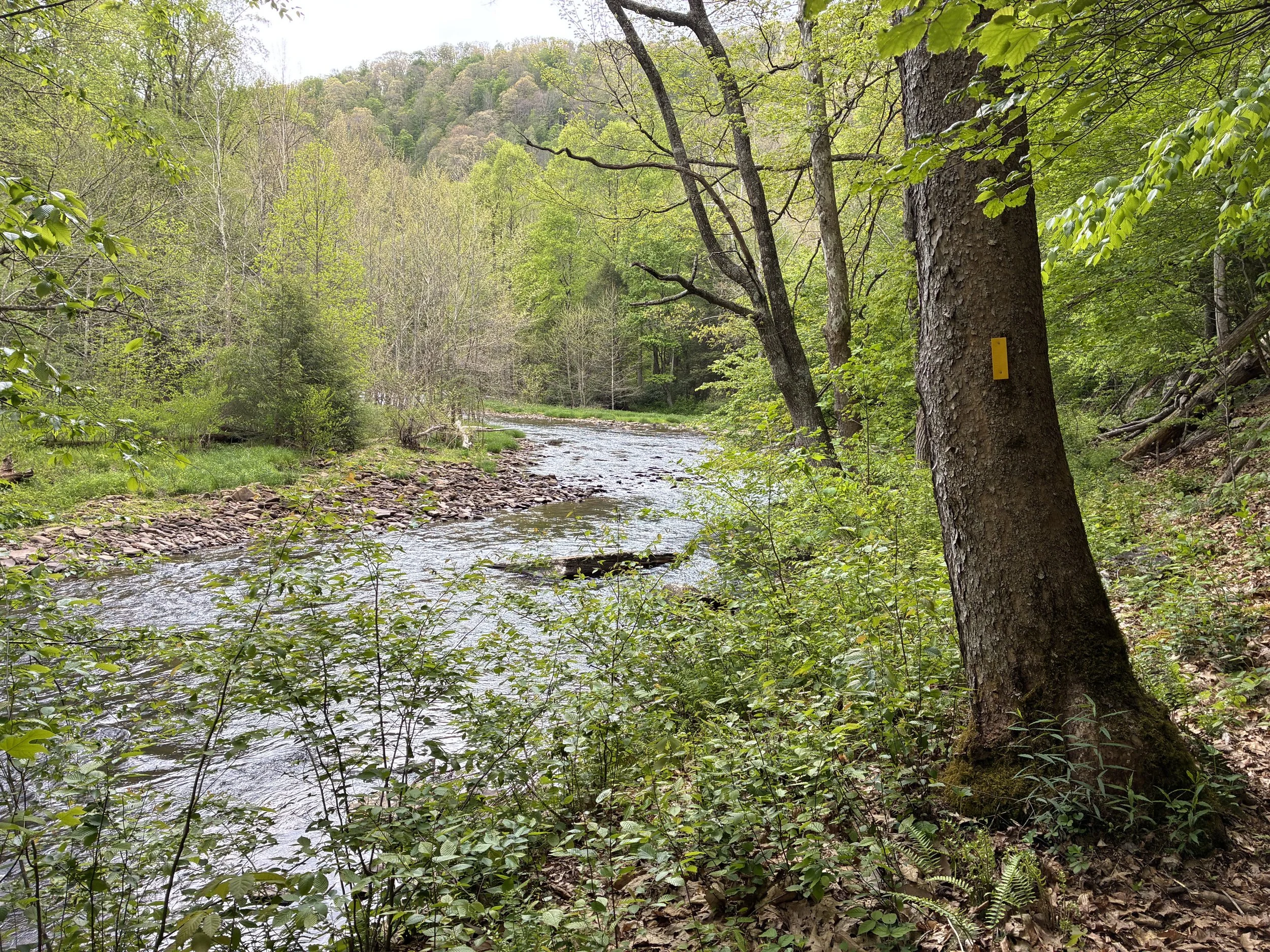
North Fork Mountain Trail and Dolly Sods Wilderness, WV
November 2024, 40 miles
-
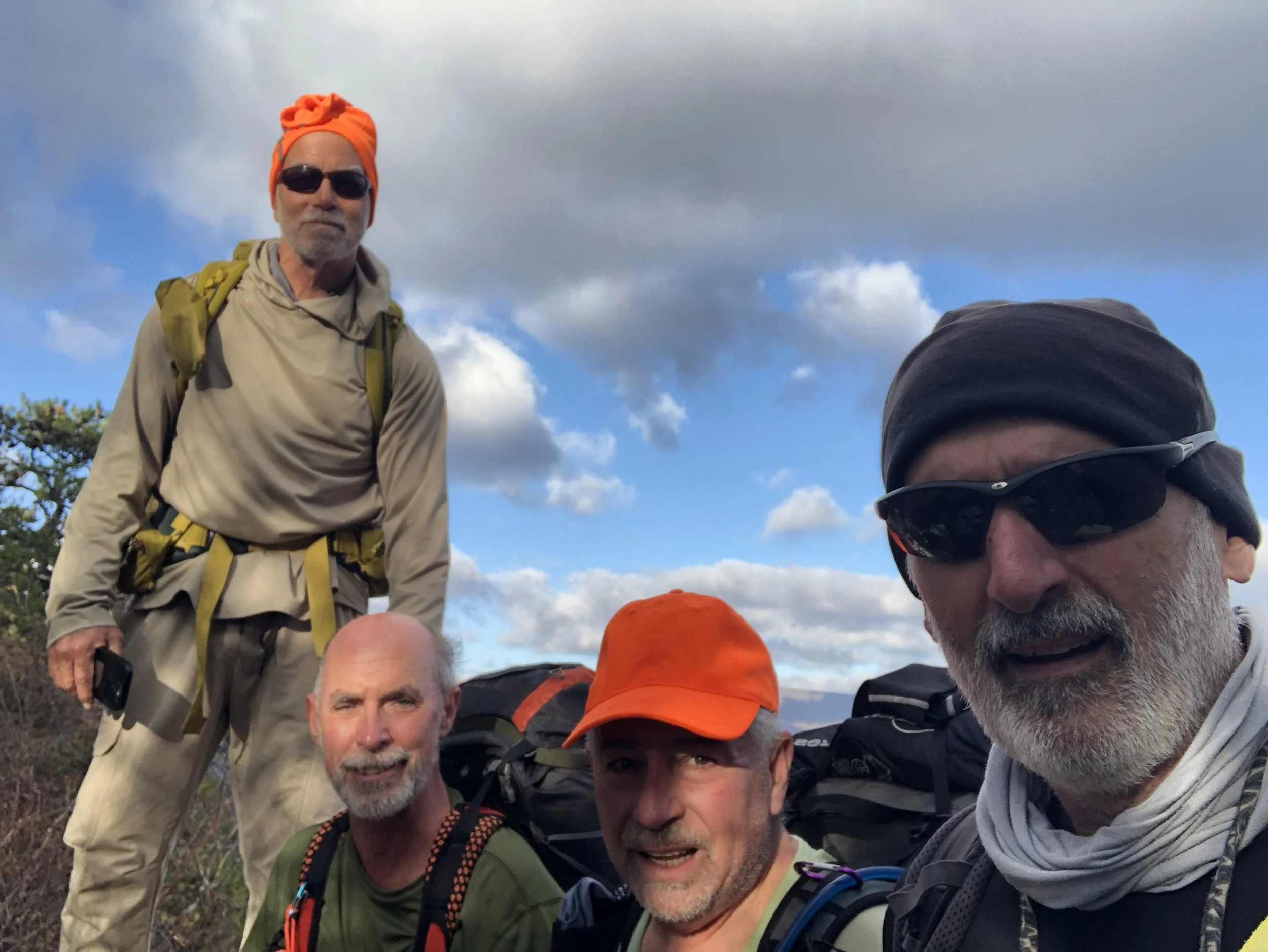
Following the ridgeline trail north along the Tuscarora Sandstone escarpment
A Wildcat, a Bulldog and 2 Mountaineers preparing for a three day trek along the scenic ridgeline trail defined by the southwest exposed limb of the breached Wills Mountain Anticline near Rt 33 on North Fork Mountain. The anticline reaches its structural culmination in just a few miles, then slowly plunges to the north, losing both structural and topographic elevation for the next 20 miles. I enjoy taking this trip in the late fall when all of the leaves are off the trees exposing more of the far-off views in both directions as we slowly head north along this wonderful trail.
-
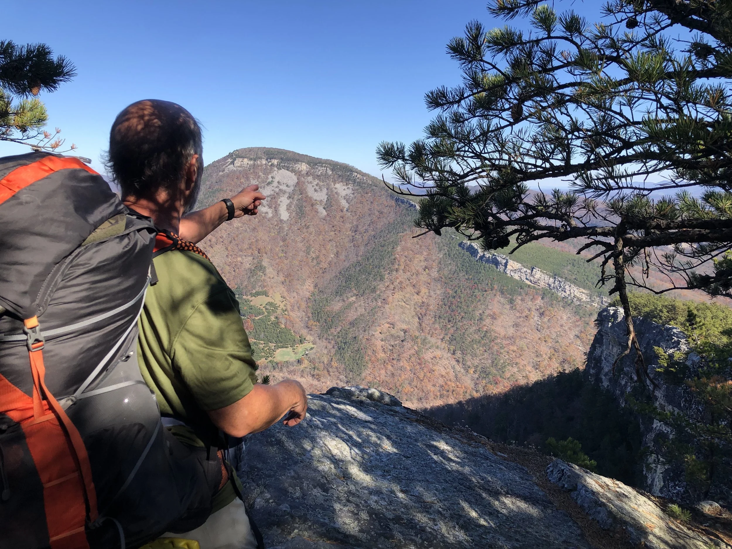
My friend Bob looking north across North Fork Gap toward the plunging axis of Wills Mountain Anticline
The North Fork Trail follows the breached southeastern limb of Wills Mountain Anticline as it slowly plunges toward North Fork Gap. After the gap the breach ends, and the axis can seen underlying and holding up the ridgeline of New Creek Mountain.
-
Overlooking Canaan Valley from Cabin Mountain
Looking southwest into Canaan Valley toward Canaan Mountain and beyond. Canaan Valley is a unique alpine valley hosting flora and fauna commonly found at much higher latitudes such as Maine and Canada. The rocks found in the ranges surrounding Canaan Valley are mostly Pennsylvanian age sandstones, resistant to weathering and thus ridgeforming. The valley itself is the result of the erosion and weathering away of the center of the doubly plunging Blackwater anticline exposing less resistant Mississipian age sands and shales of the Mauch Chunk Group and limestone of the Greenbrier Group. Exposed at the center of the breached dome are slightly more resistant Mississipian age Pocono Group sandstones
-
Hiking along Raven Ridge Trail near the northern edge of Dolly Sods Wilderness
Raven Ridge trail follows the northern boundary of Dolly Sods Wilderness crossing over the resistant Pennsylvanian age exposures of Pottsville sandstone. Views to the north reveal similar terrain in the marshy valleys surrounding Stoney Creek as it cuts deeper into the Pennsylvanian age rocks atop the Allegheny Front. To the south of Raven Ridge are views of marshlands and beaver ponds along Left Fork leading into the Red Creek Valley.
Continental Divide Trail:
Anaconda, MT to West Yellowstone, MT
Aug-Sept 2025 - 406 miles
-
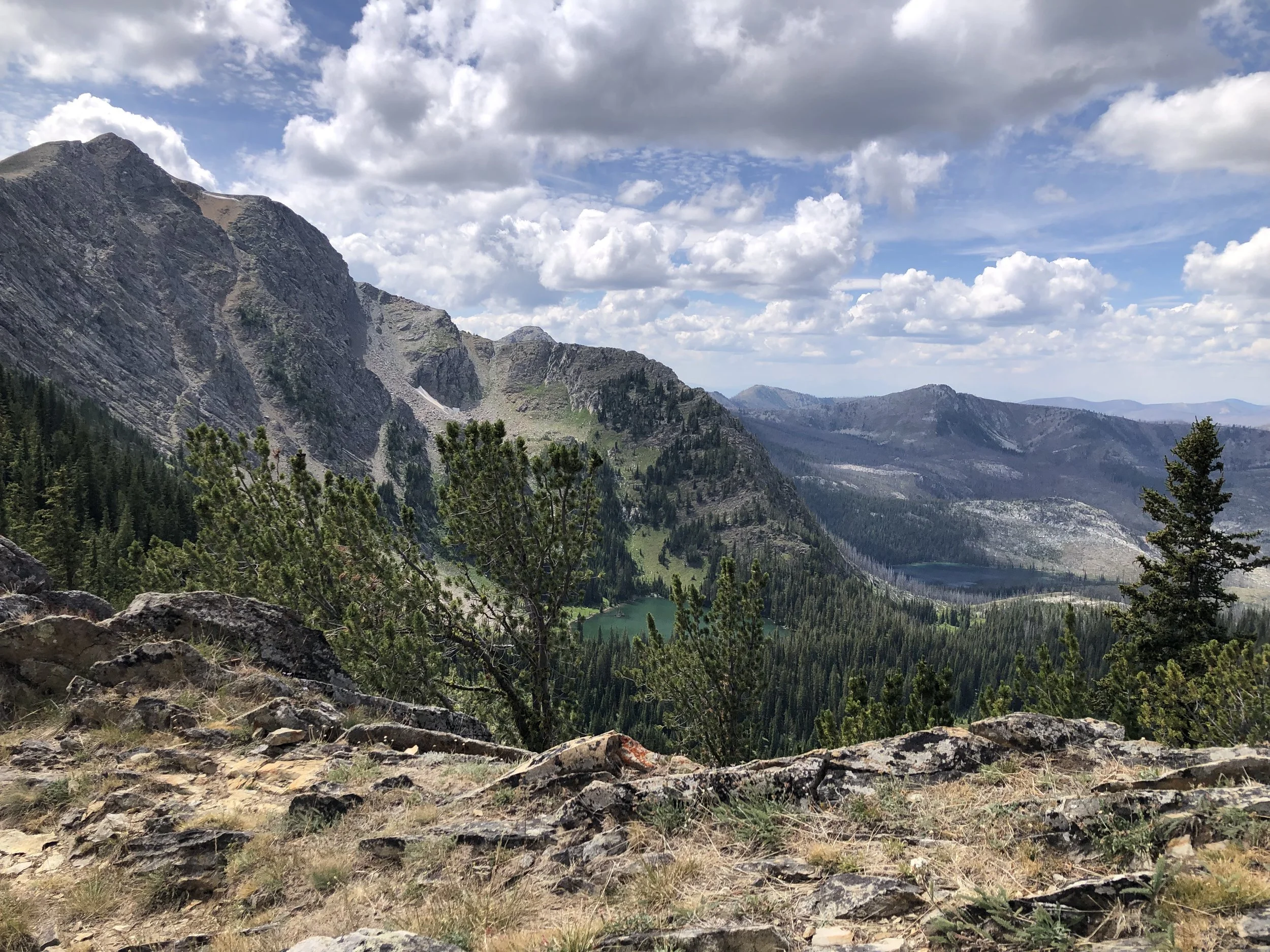
Looking southwest atop Rainbow pass into Martin Lake Cirque
Several days into my SOBO journey after beginning at Seymore Creek TH, I climbed up the steep highwall of another glacial cirque to Rainbow Pass. This would be the fifth pass I crossed over to continue my trek southbound from one glacial lake valley into the next. The rocks beneath these ridges began as sandstone, shale and limestone about 1.5 billion years ago as the basement foundation of proto-North America was being stitched together by accretion of new terranes. These sedimentary rocks were deeply buried and transformed into metamorphic rocks such as slate, phyllite and quartzite. Later tectonic uplift returned these rocks to the surface as rugged peaks. Glacial activity over the past 2 million years has scoured the bedrock and carved out the astoundingly beautiful landforms seen today.
-
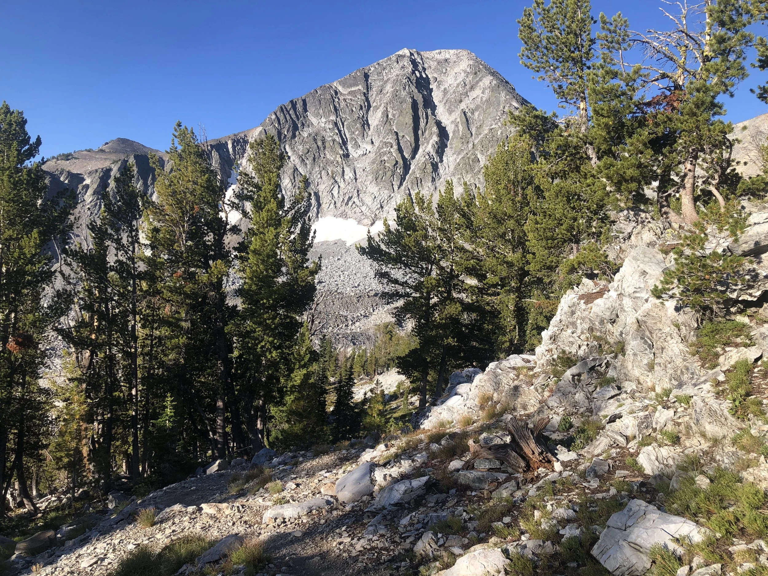
Southbound toward Hirschy Mountain
Looking south from trail toward Hirschy (Squaw) Mountain. This and the other higest peaks along this SW trending range are mostly comprised of 1.4 billion year old quartzite and argillite, mesoproterozoic age sands and shales that have been metamorphosed into tough, resistant ridge-forming units. Peaks like this are common throughout nuch of the Beaverhead mountains and represent Laramide style uplift during Cretaceous time.
-
Near Eastern edge of Beaverhead Range on ridge line of "Roller Coaster"
Along the CDT just northbound of I-15 near the Montana town of Monida is a 20 mile section of treeless ridges known as the “Roller Coaster.” This section of trail is known for its relentless ups and downs as it follows the the Montana/Idaho border. The bedrock here is the cretaceous age Beaverhead conglomerate, a syntectonic sedimentary rock formed from the uplift and erosion of these mountains during the Laramide orogeny. Most of this group formed as alluvial fan deposits and is composed of quarzite, slate and marble pebbles, cobbles and bouders of mesoproterozoic (1.4 Ma) origin.
-
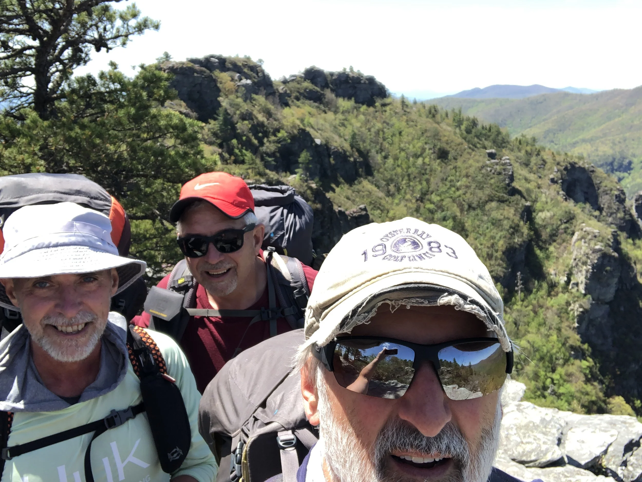
Bob, Dave and Craig at blue-line trail junction to Mack's Inn
The last 8 days of my journey began after meeting up with old friends and fellow hikers Bob and Dave. We met in Lima and together finished th elast 96 miles together as we trudged along the Centennial range, then finished up where the CDT crosses over Rt. 20 on its way to West Yellowstone. The views and scenery along the way proved breathtaking and offered much exposed geology. Rocks of sedimentary, metamorphic and igneous types could be found daily as we crossed over faults and contacts. South of us lie the Snake river plain where tens of millions of years of active volcanism culminated in the Yellowstone volcanic period and resulting caldera. That geothermal area will have to wait until next year as we plan to set off for Wyoming in August of 2026.
Allegheny Trail, Part One:
Mason/Dixon Line to Durbin, WV
April 30 - May 12, 2025 - 169 miles
-
Starting off SOBO from Mason-Dixon Line
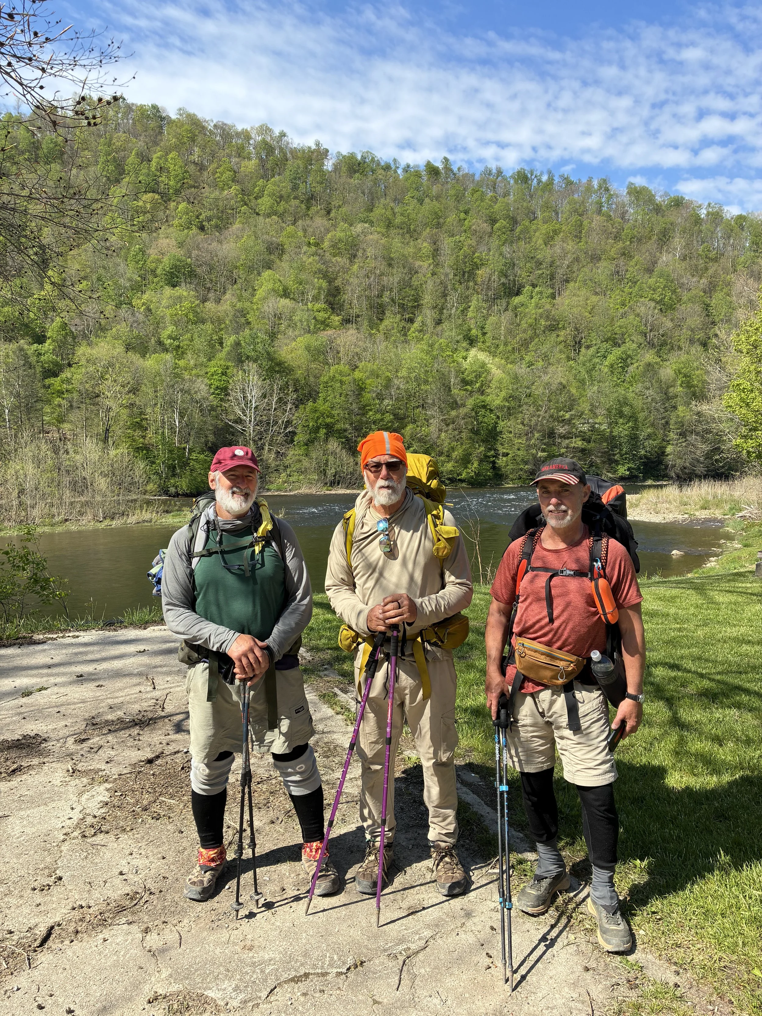
The Allegheny Trail (ALT) begins on the southeastern flank of the Chestnut Ridge anticline passing through beautiful river gorges of the Big Sandy and Cheat, and leading us through dense wooded areas, expansive pasturelands and several friendly small towns. Hiking with old friends, Dave and Bob, we start off at the northern terminus of the ALT, beginning the first half of our 315 mile journey through West Virginia. We first follow lightly used roads for about 100 miles to Davis, WV, then mostly footpaths and trails for the remainder of the journey. We decided to hike just the first (northern) one-half this season and come back in 2027 to complete the southern half. Our first night we camped in the grassy side yard of Mt. Nebo Church near Hudson, WV. Back in the 1980s, I prospected for natural gas in the Huntersville Chert and Oriskany Sandstone all over Preston County and drilled a wildcat well within a mile of where we camped for the night. Knowing this gave a sense of familiarity to our campsite that evening. After dinner, we were joined by two of my favorite geology professors from WVU, Dr Smosna and his wife Kathy Bruner. Since retiring, they bought a farm just a few miles down the road from where we were camping. It was great to spend time with them as we exchanged stories and reminisced over the wine, cheese and crackers they brought for us—marking our first trail magic for the trip!
-
Southbound along the mighty Cheat River
Much of our hike followed roads and trails along the Cheat River and its many tributaries such as Big Sandy, Blackwater, Dry Fork and Glady Fork. These waters are all stocked with trout and the Cheat in particular is popularly known for its Class IV and V rapids. On day two, we followed 9.5 miles of mixed trails and logging roads through the Cheat River gorge. This part of the gorge frequently cuts deeply into spectacular exposures of Misissippian age Pocono sandstone and Greenbrier limestone. We heard the hoots and hollering of many rafters passing by us along the way. Our plans for the night were to stay at the Friends of Cheat Campground at the end of the gorge. We thought we might be the only campers, but as we approached, people and activity could be seen through the dense foliage. As it turned out—and to our surprise—the annual Cheat River Festival was being held here for the weekend. Abounding with trail magic, we were graciously offered free beer and charcoal grilled venison steak from our friendly neighboring campers. We also enjoyed live bluegrass music while feasting on delicious BBQ from one of the many food vendors at the festival. The next morning we followed the Cheat for a while through several small towns and rural communities. We camped at a fish hatchery owned for 36 years by a friendly gentleman named Roger Cole who graciously allowed us to set up our tents behind one of his log cabins. Over the next week, we noticed natural gas wells, pipelines and other infrastructure related to the past boom days of natural gas exploration and development of the Oriskany sandstone in West Virginia.
-
Severall spectacular days following Glady Fork
After mostly road walking for the first 90 miles, Bob and i slogged through a steady downpour for three hours one morning to the the welcoming trail towns of Thomas and Davis. Here, we escaped the rain and stayed overnight at Milo’s Guest House where we could take showers, sleep in dry beds, enjoy a great dinner, do laundry, dry out our gear and resupply for the next week. Leaving Davis, we entered the deep forest trails leading us through Blackwater Falls State Park, followed by Canaan Valley State Park and eventually along Glady Fork. All these areas traversed the underlying geologic structures that I mapped in search of hidden reserves of natural gas in reservoirs such as the Oriskany sandstone and Huntersville chert. Walking along Glady fork towards the town of Glady made me think of the Glady Huntersville/Oriskany field, discovered and developed in the 1950s and one of the largest fields of its type in eastern WV. As we entered the Glady Fork valley, we passed dozens of campers in what is known as “dispersed camping” areas. Known to me as car camping. We met a friendly young guy from Clarksburg whose best friend lived in the house next door to where we lived in 1981. He gave Bob and I a pepperoni and ramp roll to split between us. More trail magic—West Virginia style!
-
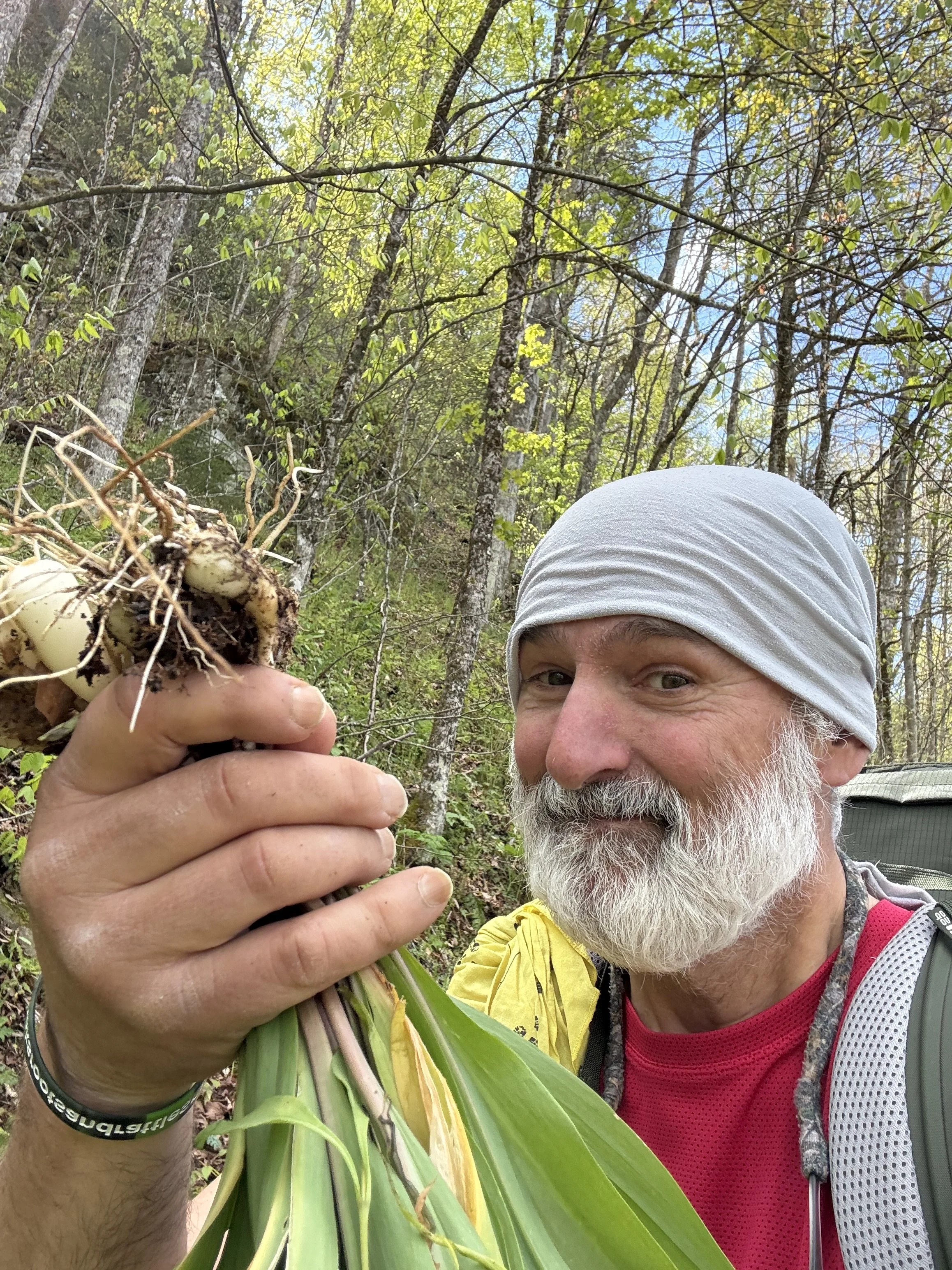
One of West Virginia's best known Spring and early Summer plants: Ramps!
As we continued south along the Glady Fork, we encountered the town of Glady, WV. First settled as a lumber producing center where a rail system was built at the turn of the century, the small town managed to survive as other boom bust cycles continuously revived its economy. Currently the natural gas industry continues its presence as the old producing Glady field is now an active gas storage field, where natural gas is generally stored in the summer and withdrawn in the winter months. Natural gas storage facilities are scattered throughout the Glady Fork valley. As the ALT exits the town, it begins following the old railroad right of way from those early timbering days which brought the town its first boom period. Soon the trail abruptly turns west and climbs to the top of Shavers Mountain. many wild flowers and edible plants are under foot as Bob and I continue south. Ramps are one of the best known “spring tonic” pplants found on the sides of these mountains, and i harvested dozens of these to accompany my evening dinners cooked over the campfire or on my pocket rocket stove. From here the ALT generally follows Shavers mountain all the way to Durbin, WV—our endpoint for part one of our 2026 ALT trek.